Climbing Capitol Peak: Everything You Need to Know
September 11th, 2024
Capitol Peak is perhaps Colorado's most notorious 14er. I’ll be the first to admit I’m not an expert in fourteeners, but my husband and I traveled down to Colorado for a week of climbing these famed Rocky Mountain peaks. We were new to the Colorado summit scene, but in our defense, we were very experienced in other mountain realms. We knew Capitol Peak was no beginner hike, and to put it into perspective, we spend most of our time in the mountains of Wyoming, where the easiest of 13ers are harder than almost all Colorado 14ers. Our background was the sole reason we put Capitol Peak on our radar, and we figured why not knock that one off the list as soon as possible.
Leading up to Capitol, we had also spent the week climbing other fourteeners in the state. Capitol was my fourth fourteener of the week, with Wetterhorn, Blanca, and Humboldt preluding it.
All this to say, we felt ready and confident to climb the Capitol, which should be required for the mountain.
Capitol Peak is one of the most difficult fourteeners in Colorado and has an elevation of 14,131 feet. It requires 5,032 feet of elevation gain on an out-and-back trail that is 15.9 miles.
The mountain can be completed as either an overnight backpacking trip or in a one-day push. Capitol Lake is the most common overnight camping spot, which does require a reservation. If you plan to camp overnight, book and plan your weekend as soon as possible, as last-minute reservations in the summer are unlikely.
If you do not have a camping reservation, climbing Capitol Peak is still entirely doable as a one-day ascent as long as you are in decent mountain shape. I recommend spending the weekends leading up to Capitol training on other 14ers.
We opted for a single-day push in early July of 2023, which ended up being a bit too early in the season. I would say Capitol Peak is best climbed from mid-July to September. If it is a low snow year, the path could be doable in early July.
You will not want to complete this route when excessive snow or ice threat, as it is considered a class 4 climb. Class 4 mountains mean they include heavy scrambling with extreme exposure. Ice & snow on routes ranked as class 4 increases dangers drastically. You do not need ropes to climb a class four route, but you will want to be comfortable and confident on very exposed terrain.
Here was our timeframe for climbing Capitol Peak in Colorado in a day:
4:30 am: Leave trailhead
7:05 am: Arrive at lake
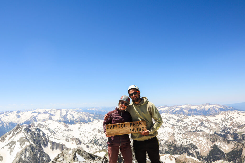
11:40 am: Summit
5:00 pm: Arrive back at trailhead
That made for a 12.5-hour day. If you do Capitol in better conditions, you can easily beat this time. Always leave before sunrise to summit as early as possible and avoid afternoon storms.
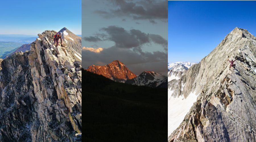
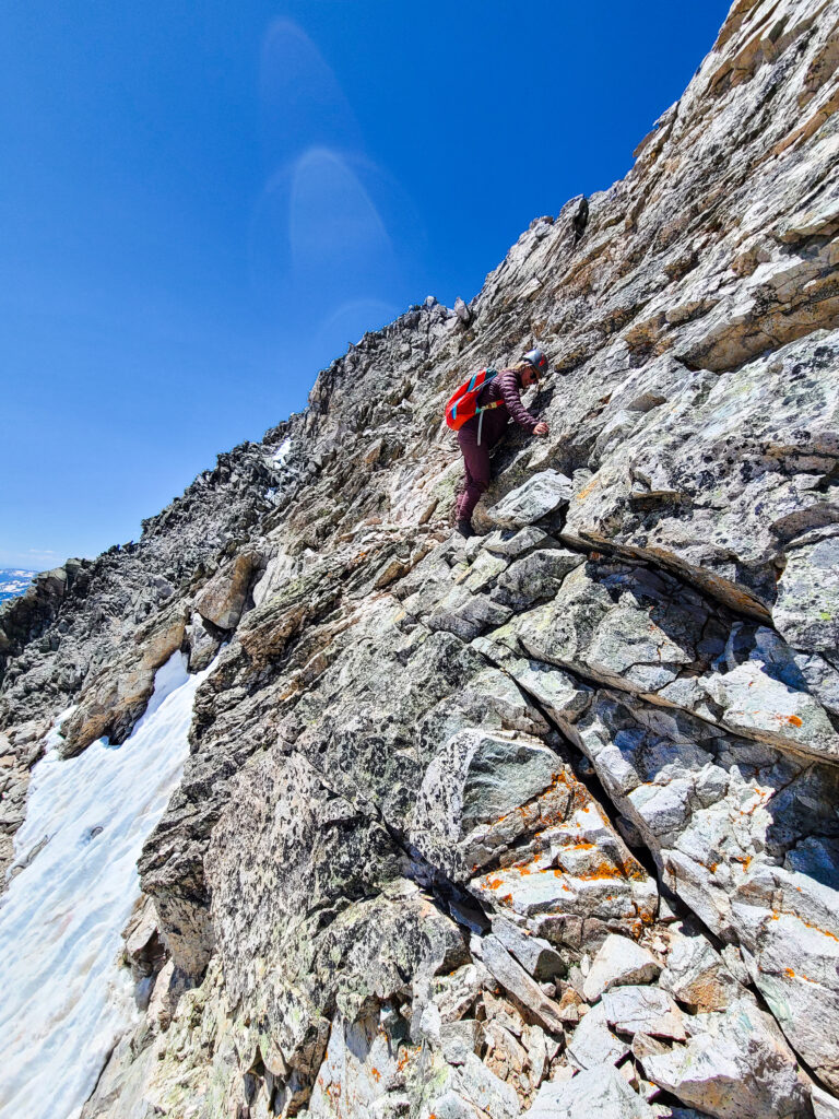
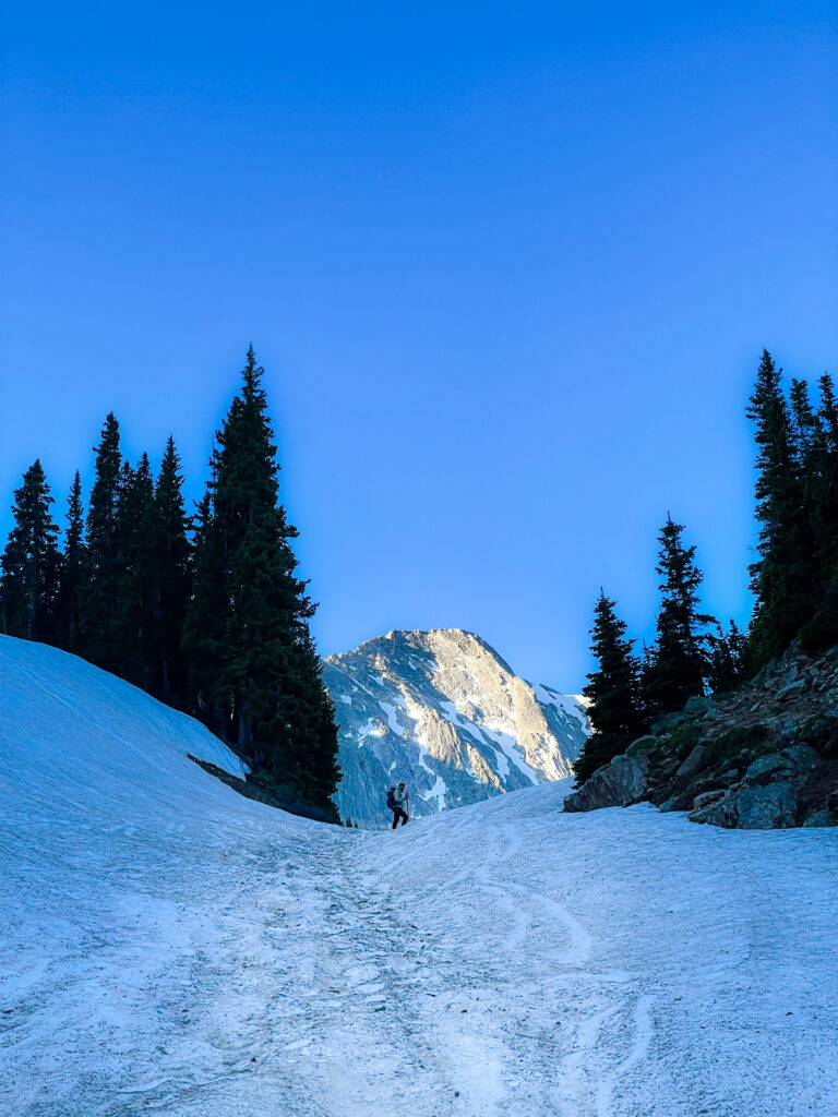
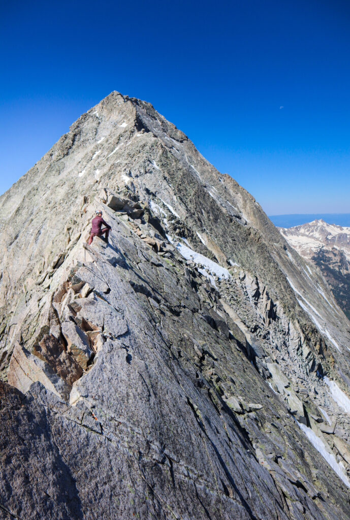
We had quite a few obstacles during our climb that would not be present later in the season. As you can see from photos, Capitol Lake was almost entirely iced, and snow covered the trail on the entire route above the ridge. There weren’t many trail reports on Capitol since it was earlier in the season, and we decided to leave our crampons and ice axes in the car, which turned out to be a bad decision. Instead of taking the standard route, the presence of icy snow forced us to scramble the entire ridgeline from the first pass to the summit. It took excessively longer on consistent class 3-4 terrain. It was spicy and not something I’d recommend for a normal ascent. Bringing our ice axes and crampons would’ve sped things up immensely.
Climbing Capitol Peak in Colorado: Phases
Phase I: Trailhead to Capitol Lake
The first phase of the hike is a relatively easy 5.8 mile well-marked trail to Capitol Lake. The trail begins at 9,472 feet and requires a little over 2,000 feet of elevation gain to get to the lake. The trail is pretty moderate and straight-forward, except for one river crossing at mile 4.6 that requires a short fjord. The fjord is shallow and easy, but there are not many large boulders to make the crossing without changing footwear or crossing barefoot. This fjord likely becomes much easier to cross later in the season.
Once you get to Capitol Lake, you will be staring at the face of the mountain. It’s important to note you don’t actually go to the lake on the trail, and instead stay just north of it to begin your descent up the pass. As you can see from the photo below, the area was still heavily filled with snow in early July 2023.
Phase II: Upper Basin
Once at lake, get ready for a steep ascent to the upper basin. The trail switchbacks up a steep pass, gaining roughly 1,000ft in a little less than a mile. It’s a short but steep section, where the views of the lower basin make it worth every step. Once at the top of the pass you cross over into the upper basin of Capitol. I am unsure what this route contains when the snow subsides, as this is the section we missed on our ascent. But it appears to climb through loose tallus on class 2 terrain until you reach K2 and begin the true scramble section of the route. It is about .9 miles between the top of the pass and the section where you hit the K2 subpeak.
Phase II: The Scramble
Now, this is where it gets fun! Once at K2, you’re sitting at roughly 13,600 feet and are only about a half mile from the summit. But don’t be fooled, this last section will take roughly 30-40 minutes and includes the infamous ‘Knife’s Edge’ Section of the route.
When you approach K2, it can be a bit confusing which way to go around the subpeak. Snow can cling to the north face well into summer, which is the standard route around the pinnacle. When snow is present, it can require some tricky navigation, but I highly recommend sticking to the north route. We thought we could easily find a way around the south side of K2 but ended up in sketchy terrain and some pretty exposed V0-V1 moves. Not a fan, hang to the right. It requires some fun route finding but is far less exposed. We took the correct way on the descent and it was much better.
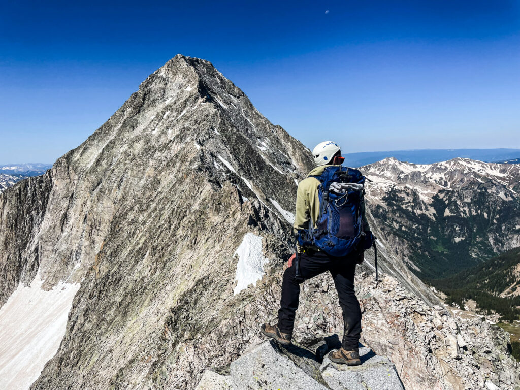
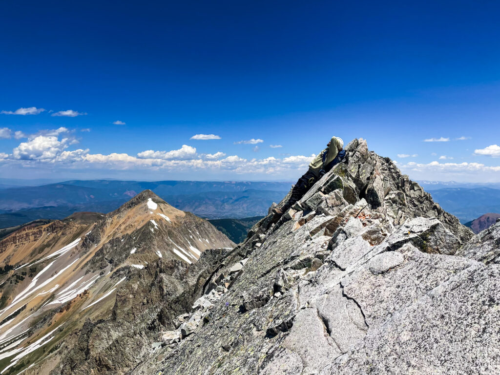
After K2, the route elevation gain subsides as you approach the knife’s edge traverse. This is what is commonly known as the crux of the route. When reading reports about the knife’s edge leading up to the climb, I won’t lie; it had me a bit scared. But I have to say it was much better than I expected. There is a lot of exposure, but the rock is very solid. Honestly, it is the best rock on the entire route. If you are scared, simply straddle the ridge and slowly make your way across.
Once you are past the knife’s edge, the final push to the summit requires more scrambling and also good route finding. The rock quality on this section is much worse and quite loose, so be sure to wear your helmets and double-check your contact points. As it was early season and there was only one other party on the mountain, we didn’t have much to go by. There are numerous routes to the top, but on the descent we found that the easiest way would’ve been sticking up high toward the ridge. We ended up taking a lower route, which was still entirely doable with high class 3 moves. Try not to go too far around the peak to the southwest, as that is where it turns to class 4 terrain. When looking at the peak, stick higher and to the right. Not right on the ridge, but just below it.
Final Thoughts on Climbing Capitol Peak in Colorado
Remember, what goes up must come down! The summit is only halfway. If possible try not to be on the summit any later than 1pm, as afternoon storms in the Maroon Bells are common. Taking the descent on the scramble slow and steady, and help out others in your group if needed. Many people underestimate that the downclimb can be more daunting than the ascent.
I would not climb Capitol Peak without the following:
- Helmet
- Energy chews
- Water filter (I use the LARQ)
- Garmin Mini GPS
- Snacks
- Raincoat and/or down jacket
- Sunglasses
- Sunscreen
- Hiking boots
- Ice axe (early season)
- Crampons (early season)
Capitol includes more exposure than many 14ers and therefore can be extremely daunting. When we climbed it, I did not necessarily enjoy it, mostly because we were stuck on the exposed ridgeline scramble for WAY longer than the standard route called for. We ended up taking the standard route down once the snow had softened, and I can say with confidence I would’ve loved the climb if we had been able to do it that way.
I hope your future summit is successful, safe, and wonderful!
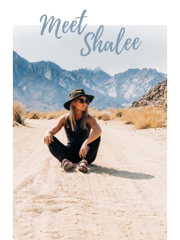
At any given moment, Shalee is either lost, hunting for ice cream, or obsessively planning her next adventure.
Born and raised in rural Michigan, she began exploring the shores of Great Lakes as a teen, often sleeping in her car to save money. Eventually, her urge to explore pushed beyond her Midwest borders. Today, Shalee shares her tips and stories to thousands of readers interested in adventure and outdoor tourism. Her pack now includes two spunky hiking cats and her partner, Josh. Learn more about her here.
Join the Adventure


