
Everything to Know About Climbing Gannett Peak in Wyoming
January 25th, 2026
By Josh Super
Many people think of the Grand Teton when it comes to Wyoming’s tallest and most famous mountain. Several would be surprised to learn that Gannett Peak, nestled deep within the gorgeous Wind River mountains, is a mere 35 feet taller. Regarded as one of the most difficult state high points in the United States, there are a plethora of route options, and none are easy. Refer to this guide first to decide if you are ready to make the long journey to the roof of the Cowboy State.
Climbing Gannett Peak: The Tallest Mountain in Wyoming
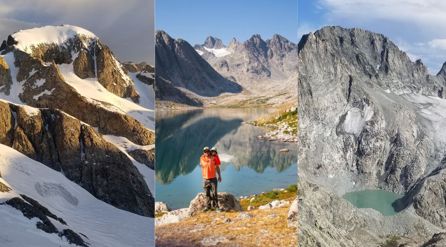
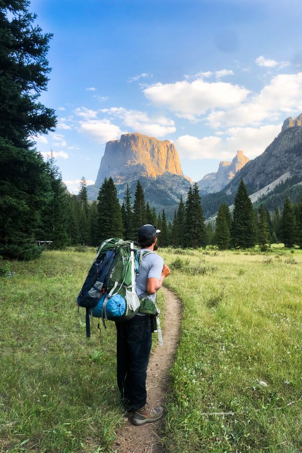
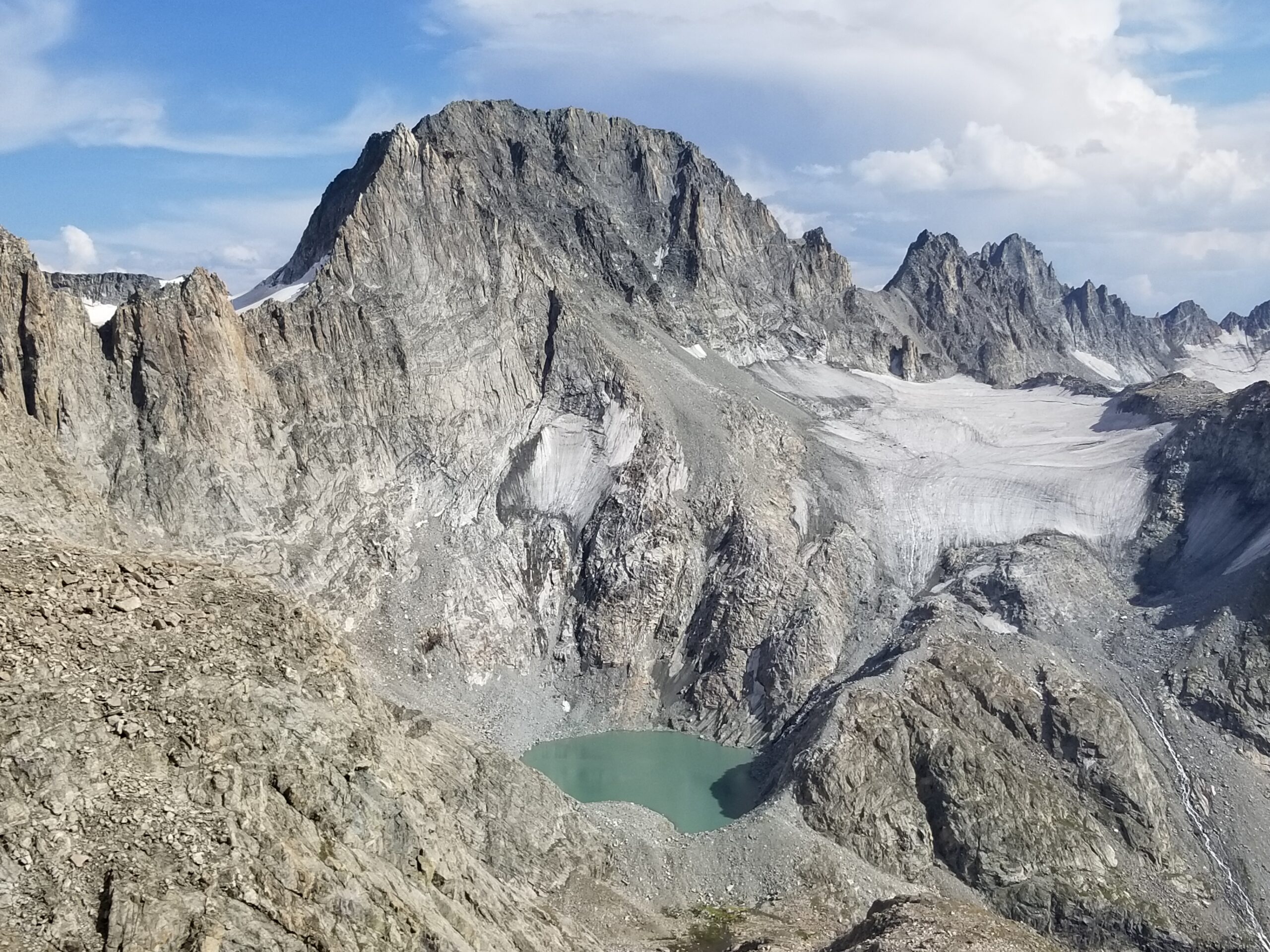
Gannett Peak is not just the tallest mountain in Wyoming. It is one of the most remote and serious alpine objectives in the Lower 48. Rising to 13,804 feet deep in the heart of the Wind River Range, this climb is less about technical difficulty and more about endurance, navigation, glacier travel, and respect for real mountain weather. There are no roads, no gondolas, and no quick exits. Every climber who reaches the summit has earned it through long miles, heavy packs, and careful decision-making.
If you are used to hiking fourteeners with trailheads that start at ten thousand feet, Gannett will feel like a completely different world. Expect multi-day approaches, snow and ice travel, and high exposure to changing conditions. This guide covers what to expect, the main routes, how to prepare, and what to pack before committing to Wyoming’s highest summit.
Route Options for Climbing Gannett Peak
1. Glacier
Glacier is still considered to be the “standard” route for the approach to Gannett, even though it requires the most mileage and technically the most cumulative gain. The trailhead is situated a bit south of Dubois (25 minutes), with an easy 2WD dirt road to access. From the trailhead, hikers follow a well-established path through forest and open meadows before gradually climbing to the broad and expansive Glacier Pass. Over the first two days, the route winds through several lake basins, meadows, marshes, and crosses several streams, eventually slowly gaining elevation without any major technical challenges. Wildlife sightings are common, including moose, elk, and bears, which is why bear-resistant food storage is required. The trail is long but never steep, making it ideal for carrying heavy expedition packs. The biggest encumbrance along the route are several bridge-less stream crossings, which require trivial fords except for peak early-season runoff. A bit tedious for keeping feet dry
After about 25 miles, climbers reach the typical base camp areas near the upper Dinwoody Creek basin. From here, the terrain shifts from backpacking to mountaineering. The trail fades into moraine, rock, and glacial runoff as the Dinwoody Glacier comes into view. Most teams establish a high camp near the toe of the glacier, which positions them for an early summit push.
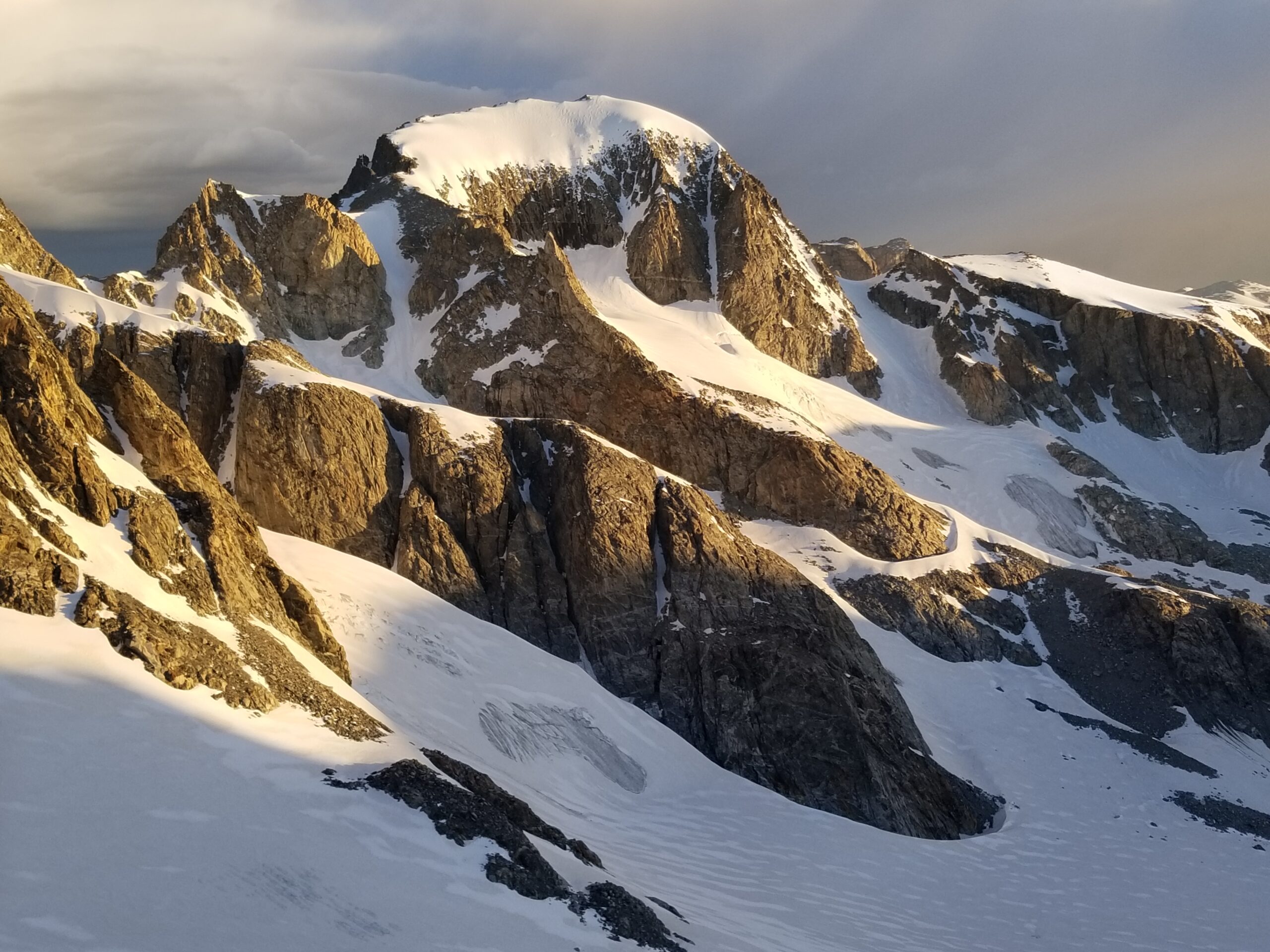
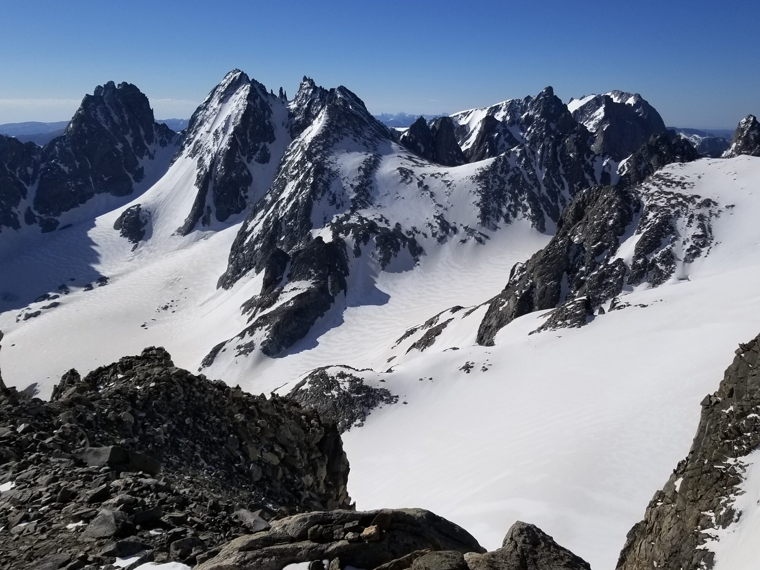
Summit day usually involves an alpine start beginning anywhere from midnight to 5am. Depending on the time of year, you’ll either be winding through the moraine scree and talus or transitioning to ice and snow early on. Although there isn’t much crevasse risk lower down, you’ll probably still rope up at the transition point like most glaciated climbs. 3 / 4 of the major routes ascend via the Gooseneck, which includes the infamous bergschrund. This is a large gaping trench right as the grade transitions and narrows to ascend the steepest section of the Gooseneck ridge. This feature tends to be a focal point when it comes to planning the time of year for the ascent.
Most years, the bergschrund tends to begin opening around mid-July, and doesn’t truly start to become a problem until August. The more the season progresses, the worse it gets. And alternatives aren’t easy to come by, with the only practical bypass being some low class 5 rock climbers left. In August, with good weather, it will usually depend on the fortitude of the snow bridge that will determine whether your summit attempt will be a success or not. Some groups get quite crafty through this section, but may require some advanced risk management to ascend and descend without tumbling into the narrow abyss.
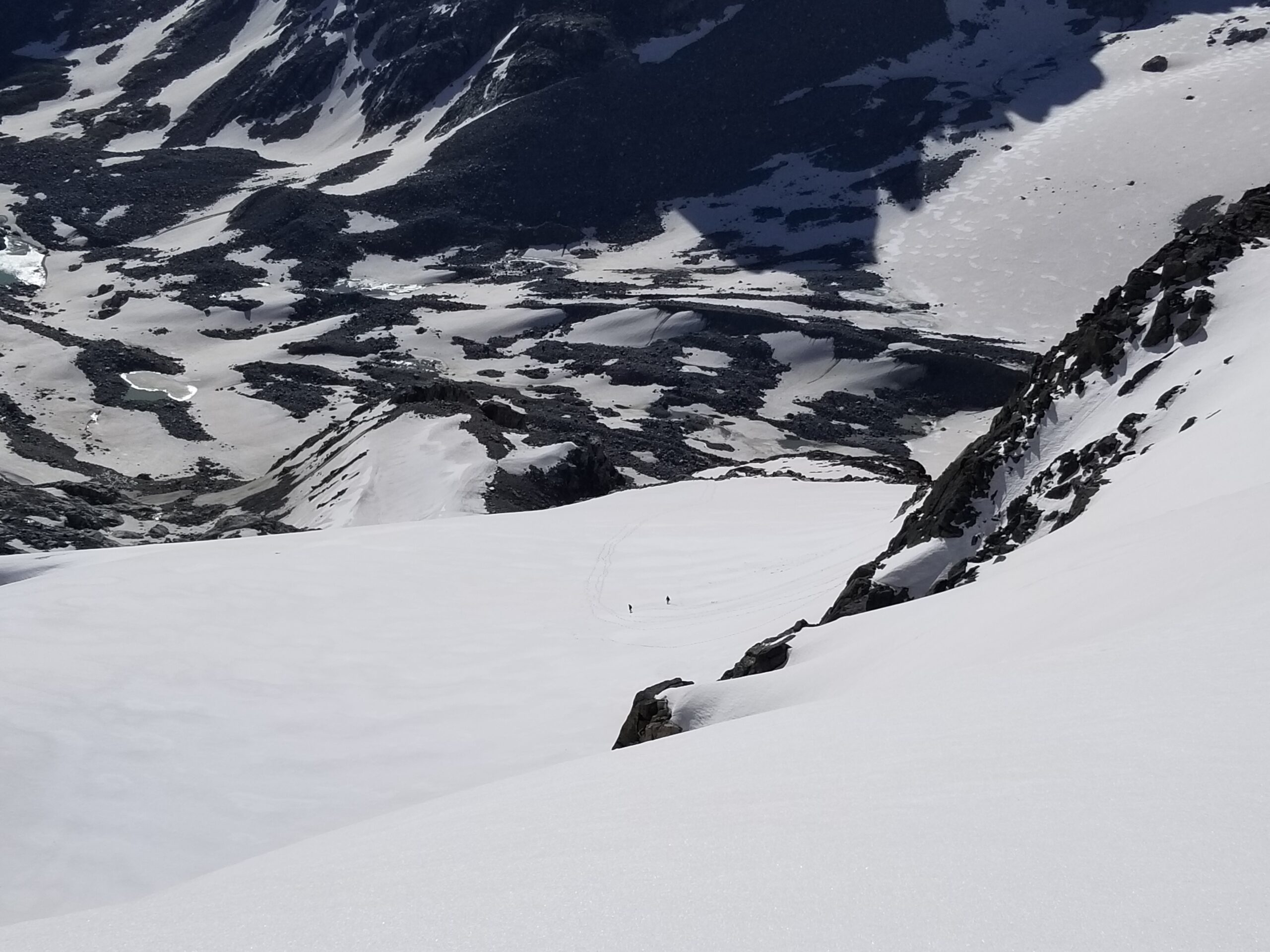
Obstacle conquered, it's time to ascend steep snow and perhaps some mixed up the Gooseneck Glacier up past the distinctive Gooseneck Pinnacle. Most years there should be a pretty definitive bootpack to follow. Once on top of the ridge, the rest of the route up to the famous broad sloping summit feature is laid out before you. It is normally an easy finish, but this is a really bad spot to be if storms are around, or in icy conditions. Be sure to assess conditions beforehand, and focus on the task at hand. Along the way, enjoy some of the most incredible views you’ll see in the lower 48, if not the world.
Outside of the majestic local 13ers - particularly the cirque from Woodrow Wilson to Turret, you’ll be able to easily spot the famous Teton sprawl, the Absaroka mass to the north, and perhaps even the Utah Uintas off in the distance to the south. Congratulations! You have just reached the tallest point in Wyoming, a remarkable achievement to say the least. Perhaps overstated, but remember the summit is only a job halfway done, and on some summits, the descent could be the crux of the climb. Take extra care as you retrace your route back to camp.
Stats Snapshot:
- RT Miles: 56 Miles
- Total Gain: 10,500 feet
- Technical Notes: Glacier Travel, Grade I/Class 3 Rock
- Pros: Straightforward Route, Good Camps
- Cons: Highest Mileage, Stream Crossings
2. Titcomb Basin/Bonney Pass
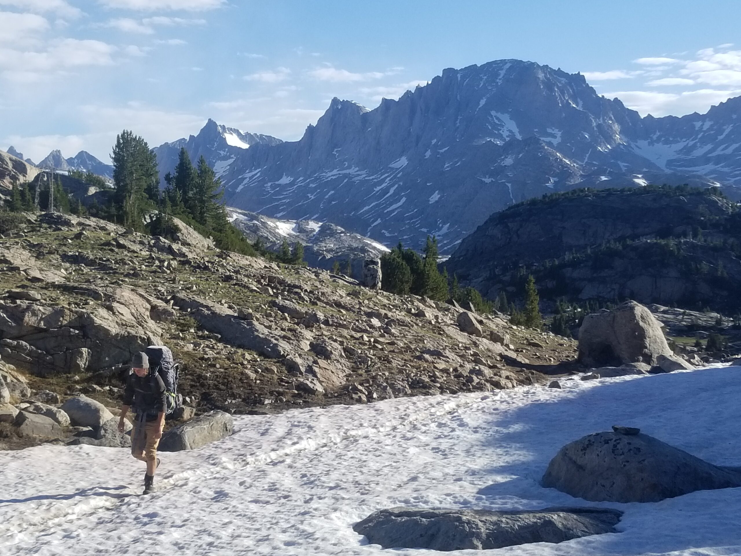
The Titcomb Basin byway to Gannett has historically been the alternative approach to access the Gooseneck. This begins at Elkhart Park, from the south, near Pinedale, also about a 25-minute drive on good pavement and dirt suitable for 2WD vehicles. The trail starts quite high, around 9400 feet, and gradually climbs for several miles to an exceptional viewpoint of the core of the 13ers at Photographers Point.
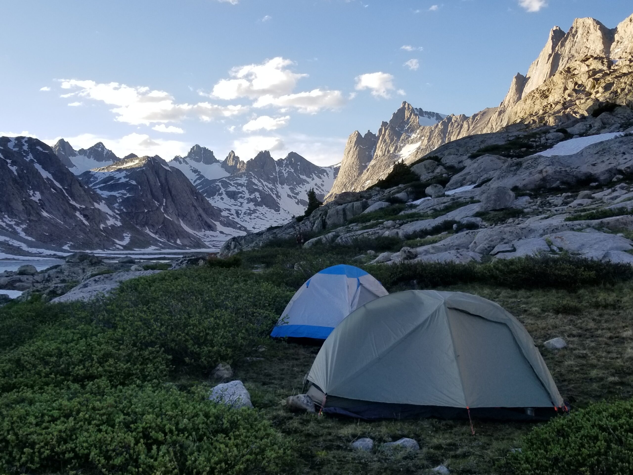
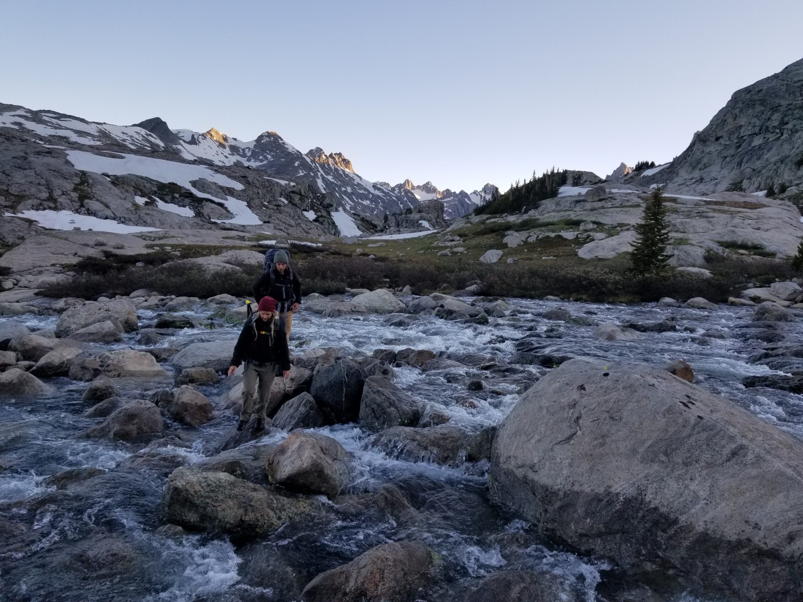
From here the trail loses elevation a bit with a few short sections of steep ascent and descent, crossing a couple lake outlets that may require a brief ford in June and July. You’ll pass the Seneca Lakes complex, then a pass before descending to Island Lake. There are few trees left as you transition to the full glory of the alpine wonderland. Maybe one or two more adventurous rock hops or stream fords, then Lower Titcomb Lake is not much further. Enjoy scenic splendor as you hike the last few miles to a standard base camp in the basin north of the upper Titcomb Lake.
The major disadvantage of this route comes on summit day, unless a bivvy on top of the dreaded 12,281-foot Bonney Pass is on your itinerary. Either way, you’ll have to ascend a steep and usually unpleasant 1200+ feet both ways. Early season can be a bit more enjoyable as there will likely be snow covering most of it, with a risk of treacherous ice. Later on, this becomes loose scree with other jumbled talus chunks mixed in. If early enough, you’ll need your crampons and ice axe here. No need to rope up; crevasses will not be a concern. Make it to the top and get your first faceful of an absolutely classic view of Gannett (unless its still dark).
Descend steeply back down the other side and transition onto the massive Dinwoody Glacier. Man-eating crevasse risk is low, until nearing the nadir and transition to the standard Gooseneck route, but still best to be safe and roped up the entire way upon entering the Dinwoody.
On the return, you’ll be sure to curse your route choice as you reascend the thousand-plus feet back up to the pass. If you’re lucky, you may be able to glissade down the steep snowfinger on the other side like I did. Just be sure to have your ice axe ready, it's a fast ride!
Stats Snapshot:
- RT Miles: 42
- Total Gain: 9,200 feet
- Technical Notes: Glacier Travel, Grade I/Class 3 Rock
- Pros: Most Scenic Camps, High trailhead
- Cons: Tough Summit Day, High Pass Crossing x2
3. Tourist Creek
The last main route to approach Gannett is through the drop-dead-gorgeous Green River Lakes access. This route is becoming more popular in recent years as it bypasses most of the technical glacier travel - including the gooseneck bergschrund feature, while being the shortest in total distance and cumulative gain. The best time to execute a summit bid via this side would be mid to late August (until an early fall snowstorm), where most, if not all, of the snow and ice should be melted off on the final approach.
You begin with a long, nearly 2-hour drive north from Pinedale. It's on a good paved road for a while, but the last 55 minutes are on a slow, often potholed and washboarded dirt road. It's 2WD-able, but you’ll want as much clearance as you can get.
Setting off from the trailhead, the views are stunning right away as you traverse both Green River Lakes as you stare intently at the famous Squaretop mountain down the valley, getting closer with every step. As you leave the lakes behind and continue to follow the iconic Continental Divide Trail, the terrain becomes all the more dramatic on each side. Green River starts as a serene, silent meander but develops into a more audible mountain stream as you continue up the valley to a popular camping base at Beaver Park. You can continue the few miles up to the next opportune meadow at Three Forks Park, close to the outlet of Tourist Creek. This is the last bit of maintained trail you will encounter for the rest of the ascent (unless opting for the Wells Creek entrance).
Some parties may opt to go for the summit from here, but it will be a long and exhausting summit day. Most will ford the Green River (generally calm waters but fairly deep in a few spots), and continue up the Tourist Creek drainage. This is where the unpleasantries begin, as it requires an initial dense bushwhack, then a long and somewhat steep traversing talus hop, with some danger regarding shifting boulders. The right (south) side is best. You will need to route-find carefully, as there is no established route.
Sometimes social trails appear and then fade as quickly as they materialized. This initial section of the drainage is probably the most unpleasant. You will continue up the drainage, with lots more rock-hopping. After about 2 miles, an obvious fork will appear on the right side. By no,w the trees have disappeared, and the social trail should be more distinctive to the point you can follow it up to the lakes basin above. From the crossing of the Green River it’s about 3.5 miles of rugged country and 2800 feet of net gain. This unnamed lake at an elevation of 11085 makes an ideal and scenic location for a final camp.
On summit day, you will descend a short, steep ramp to an unnamed tarn, then follow a long bench eastward over Scott Lake. Keep descending gradually, following this mostly obvious wide ledge to a long, unnamed lake at 10795, and traverse through on the north side. From the lake inlet, follow the drainage and scramble up talus with whatever line suits you best until you reach the cusp of the Minor Glacier. From here, pick the path of least resistance through the dying glacier and moraine, aiming for an obvious ramp leading to Gannett’s north ridge. Depending on how early or late you find yourself here, you may still need crampons/ice axe, but often the ice and snow can be bypassed for rocky alternatives.
Once on Gannett’s north ridge, the crux of the scrambling will be encountered in low class 4 sections. Careful routefinding will assist in keeping the scrambling low in difficulty and exposure. There are a few rap stations, cairns, and other signs of human travel that can be found along the way to assure you’re following the correct line. Soon the scrambling ends and it is a short walk to the acclaimed summit!
As usual, the descent has the capability to be just as hard. Rockfall is an increased risk for this route, and extra caution will be necessary, especially in larger parties.
Wells Creek alternative: The Wells Creek drainage is a slight alternative to access the Minor Glacier and the West Face of Gannett. Just like Tourist Creek, you must cross the Green River and follow the south side of the creek, encountering plenty of steep bushwhacking and talus hopping/scrambling. At a certain point, you will reach an obvious impasse, a large cleft of rock that will require about 100’ of 5.4-5.6 YDS climbing. Rope and trad gear may be needed to ascend this obstacle as well as being needed to rappel this feature. From there, you must navigate a narrow ledge and traverse the long, slender waterway to Scott Lake. Ascend to unnamed 10795 to join the Tourist Creek route. The benefit of this route is to save more than a mile of tough backcountry terrain and at least 400 feet of extra gain.
Stats Snapshot:
- RT Miles: 38
- Total Gain: 8,000 feet
- Technical Notes: Class 4 Rock
- Pros: Lowest Mileage, Lowest Gain, Least Snow/Ice Travel
- Cons: Most Routefinding, Talus Sidehilling, Bushwhacking
4. Ink Wells
Ink Wells is a lesser-used alternative approach that joins the Glacier Trail, saving about 10 total miles and about 2500’ of gain. It is technically the easiest approach method for Gannett, but it requires a sacrifice in the form of logistics and an expensive transportation/permitting process through the Wind River Reservation.
After purchasing a weekly or multiple daily tribal permits and arranging a shuttle through services in Crowheart, you will have a long, hour-and-a-half ride via rough 4WD roads to the Cold Springs trailhead. From there, you will hike over the long broad Scenic Pass and begin descending to the Dinwoody drainage, passing Echo Lake on your way to the junction with the Glacier Trail. It is about 10 miles from the trailhead to the junction.
More information on this approach can be found here - https://www.reddit.com/r/Mountaineering/comments/1i1ah2b/gannett_peak_wy_beta_for_cold_springs_trailhead/
Stats Snapshot:
- RT Miles: 45
- Total Gain: 8,600 feet
- Technical Notes: Glacial Travel, Grade I/Class 3 Rock
- Pros: Highest Trailhead, Easiest Approach
- Cons: Tribal Logistics, Trailhead Navigation, Cost
Enjoy a classic route and don’t mind extra elevation gain? Take the Titcomb Basin/Bonney Pass approach. Do you enjoy a classic, straightforward route and don’t mind extra mileage? Take the Glacier Trail approach. Are you a scrambler that enjoys traveling fast and light, and avoid glacier travel if at all possible? Take the Tourist Creek approach. Do you like a good shortcut and don’t mind paying for it? Take the Ink Wells approach.
What to Pack for Climbing Gannett
Packing List for Gannett Peak
Because this is a multi day alpine expedition, your gear choices matter.
Climbing and glacier gear:
- Mountaineering boots
- Crampons
- Ice axe
- Helmet
- Harness
- Rope
- Carabiners
- Prusiks or mechanical ascenders
- Crevasse rescue kit
Clothing:
- Insulated jacket
- Waterproof shell jacket and pants
- Lightweight down or synthetic layer
- Base layers
- Gloves and mittens
- Warm hat and sun hat
- Sunglasses
Camping and backpacking:
- Four season or sturdy three season tent
- Sleeping bag rated for freezing temperatures
- Sleeping pad
- Backpack 60 to 75 liters
- Stove and fuel
- Lightweight cookware
- Water filter or purification tablets
- Bear resistant food container
Navigation and safety:
- Topographic map
- GPS device or phone with offline maps
- Headlamp with extra batteries
- First aid kit
- Emergency Beacon
- Sunscreen and lip balm
Food and hydration:
- High calorie meals
- Energy bars and snacks
- Electrolyte Supplements
- At least two liters of water capacity
How Many Days Do You Need to Climb Gannett Peak?
This will depend on your pace, and which route you decide to take. Note that everyone seems to have a different pace when it comes to trail travel, glacial travel, bushwhacking, and climbing/scrambling. It will also depend on snow conditions, difficulty of stream crossings/other obstacles, and group size.
Glacier Trailhead (Northern) Approach:
Standard Itinerary - 6 days / 5 nights
Day 1 Camp - Double Lake area (11 miles)
Day 2 Camp - Wilson Meadows (10 miles)
Day 3 Camp - Moraine/Base Camp (6 miles)
Day 4 (Summit) Camp - Moraine/Base Camp (7 miles)
Day 5 Camp - Honeymoon Creek (13 miles)
Day 6 Departure - 14 Miles
Expedited Itinerary - 4 days / 3 nights
Day 1 Camp - Honeymoon Creek (14 miles)
Day 2 Camp - Moraine/Base Camp (13 miles)
Day 3 (Summit) Camp - Ink Wells Junction (14 miles)
Day 4 Departure - 19 Miles
Elkhart Park Trailhead (Southern) Approach:
Standard Itinerary - 5 days / 4 nights
Day 1 Camp - Seneca Lake area (10 miles)
Day 2 Camp - Upper Titcomb Basin (7 miles)
Day 3 (Summit) Camp - Upper Titcomb Basin (9 miles)
Day 4 Camp - Seneca Lake area (7 miles)
Day 5 Departure - 10 Miles
Expedited Itinerary - 3 days / 2 nights
Day 1 Camp - Lower Titcomb Basin (15 miles)
Day 2 (Summit) Camp - Island Lake (16 miles)
Day 3 Departure - 13 Miles
Green River Lakes Trailhead (Western) Approach:
Standard Itinerary - 5 days / 4 nights
Day 1 Camp - Beaver Park (10 miles)
Day 2 Camp - Unnamed Lake 11085 (6 miles)
Day 3 (Summit) Camp - Unnamed Lake 11085 (8 miles)
Day 4 Camp - Beaver Park (6 miles)
Day 5 Departure - 10 Miles
Expedited Itinerary - 3 days / 2 nights
Day 1 Camp - Three Forks Park (12 miles)
Day 2 (Summit) Camp - Three Forks Park (15 miles)
Day 3 Departure - 12 Miles
Ink Wells Trailhead (Eastern) Approach:
Standard Itinerary - 5 days / 4 nights
Day 1 Camp - Echo Lake (9 miles)
Day 2 Camp - Moraine/Base Camp (9 miles)
Day 3 (Summit) Camp - Moraine/Base Camp (7 miles)
Day 4 Camp - Echo Lake (9 miles)
Day 5 Departure - 9 Miles
Expedited Itinerary - 3 days / 2 nights
Day 1 Camp - Wilson Meadows (14 miles)
Day 2 (Summit) Camp - Wilson Meadows (16 miles)
Day 3 Departure - 14 Miles
What to Know About Weather in the Wind River Range
Although the weather in the Winds isn’t known to be as particularly severe or automatic as the Colorado Rockies or Beartooths - as a regional example, there is still plenty of opportunity for afternoon storms. The day I summited Gannett, I was surprised by an 8am storm! (very uncommon). I was fortunate that it just barely missed to the north.
As with many dramatic mountain ranges, there are not many places to escape exposure up in the high alpine when a storm rolls in. Granite conducts electricity fairly well, making an emergency shelter risky. The best practice is to drop elevation as quickly as possible, which could prove tricky on the steep and technical terrain presented on all routes. The best practice is to budget enough time on an alpine start to be back below 11,500 feet by noon (budget more time for the Bonney Pass route as you will have to reascend to 12,800’). Although the weather forecasts aren’t perfect, sites such as Mountain-Forecast generally are fairly accurate for storm risk on a particular day. Try to choose the day with the lowest risk if you have any flexibility with your itinerary, and pay close attention to the skies! This could be more of an issue with the eastern and southern approaches, as the peaks will block sight lines to the western skies, where storms typically arrive from.
Another worthwhile thing to note is that the snow in the Winds lingers much longer than most other Rocky Mountain ranges. In a typical year, the winter snowpack won't dissipate above 11,000 feet until Mid-July. When we attempted Gannett in early July, there were still significant snow slowdowns on the trails to Titcomb basin, and creek crossings, especially, were at a near-maximum flow rate due to the snow melt, making the crossing difficulty much higher. There will be a lot of tradeoffs depending on hazards and advantages, depending on the time of year you choose to attempt Gannett, but most parties find August to be the most ideal, due to the generally more stable weather and conditions.

At any given moment, Shalee is either lost, hunting for ice cream, or obsessively planning her next adventure.
Born and raised in rural Michigan, she began exploring the shores of Great Lakes as a teen, often sleeping in her car to save money. Eventually, her urge to explore pushed beyond her Midwest borders. Today, Shalee shares her tips and stories to thousands of readers interested in adventure and outdoor tourism. Her pack now includes two spunky hiking cats and her partner, Josh. Learn more about her here.
Join the Adventure


")