
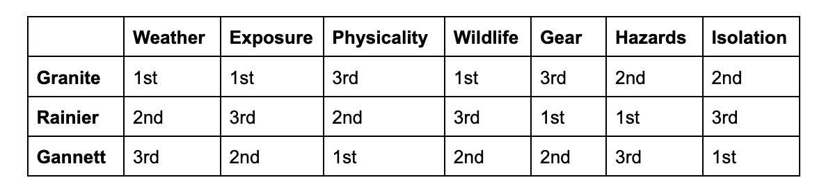
Granite vs. Granite vs Rainier: What is the Hardest U.S. State Highpoint?
March 17, 2026
There’s a common debate in the U.S. Highpointing Club: Which state highpoint is the hardest?
I mean, yes, we can all likely agree Alaska’s Denali kicks the ass of every other mountain on the list, but in the contiguous 48, there is often a close debate between Granite (Montana), Gannett (Wyoming), and Rainer (Washington).
Determining the toughest highpoint in the lower 48 states is never just about elevation, it’s about the combination of terrain, weather, remoteness, and technical skill required to reach the summit. Each mountain presents a different type of challenge: massive glaciers and unpredictable weather on Rainier, extreme remoteness on Gannett Peak, and rugged alpine scrambling on Granite Peak.
But which of these iconic summits is actually the hardest to climb?
This article compares Mount Rainier, Granite Peak, and Gannett Peak across several key factors that define climbing difficulty, including technical climbing requirements, total elevation gain, objective hazards, weather exposure, and logistical challenges, from the first hand experience from someone who has climbed them all.
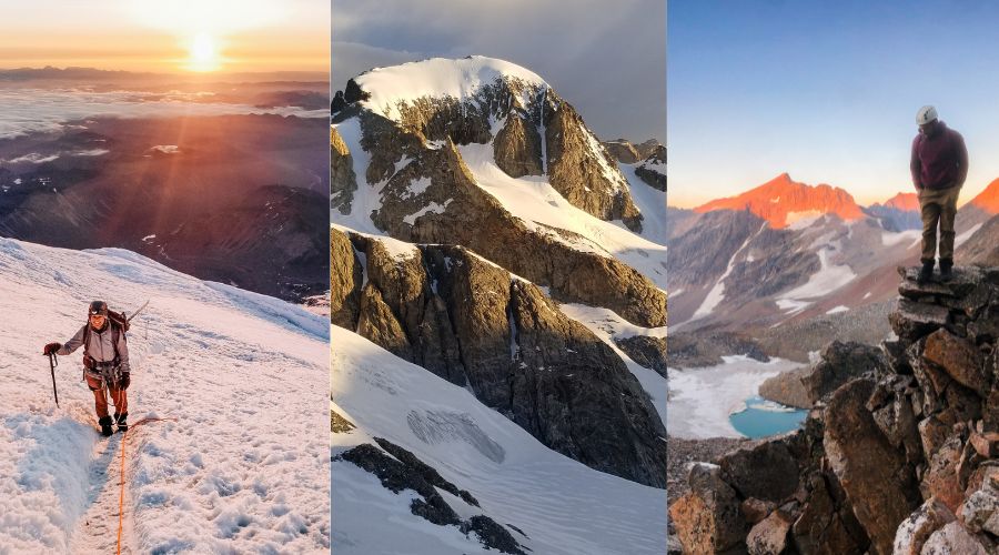
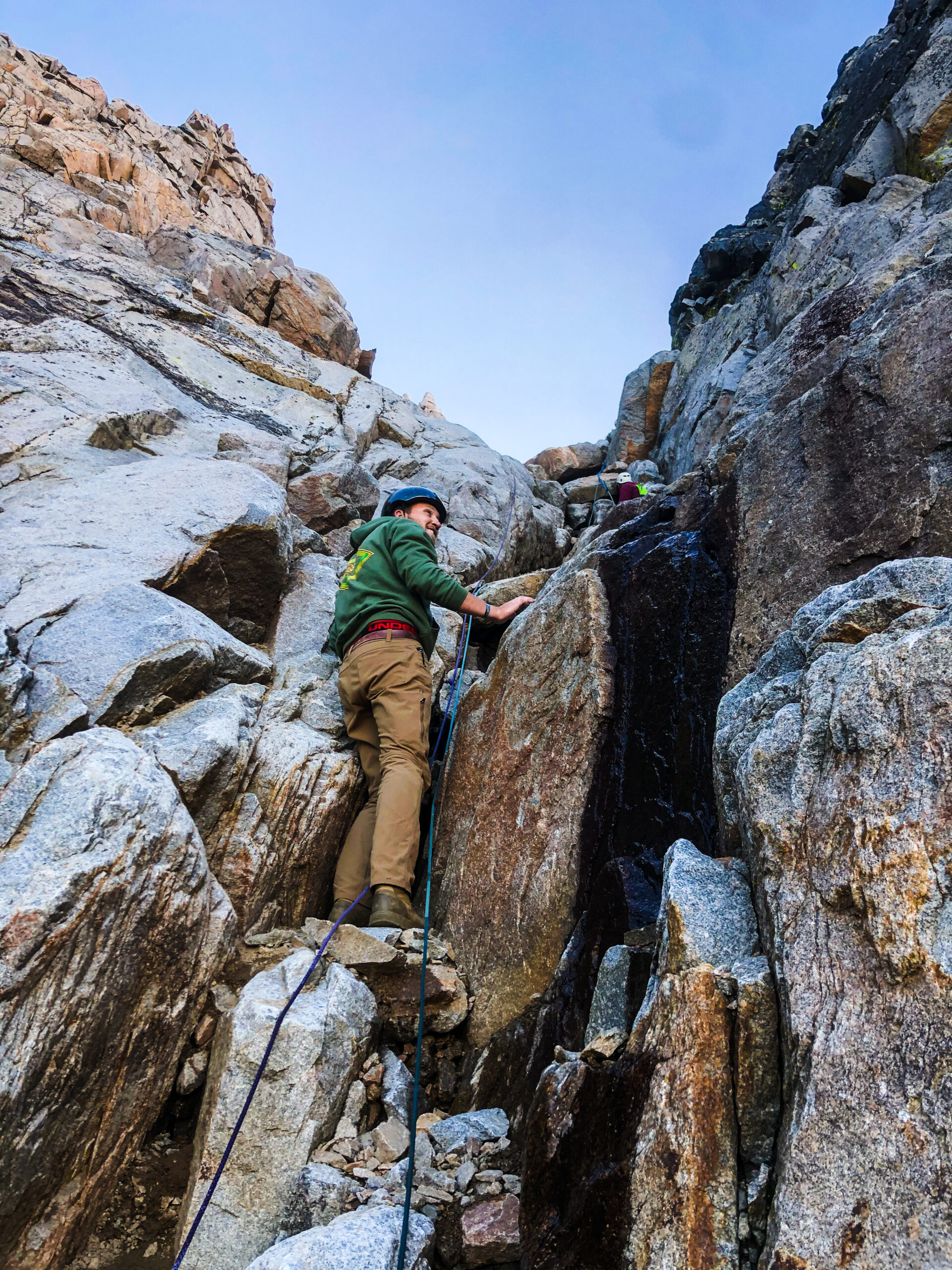
Nearing the summit of Granite Peak
Granite vs. Gannett vs Rainier: Mountain Summaries
Granite Peak is the highest mountain in the U.S. state of Montana, rising to an elevation of 12,804 feet (3,903 meters) above sea level. The peak is located in the rugged Beartooth Range, a dramatic subrange of the Rocky Mountains that straddles the Montana–Wyoming border. Granite Peak is situated within the Absaroka-Beartooth Wilderness, an area known for its remote alpine terrain, glacial valleys, and exposed ridgelines.
Mount Rainier is the highest mountain in the U.S. state of Washington, rising to an elevation of 14,406 feet (4,391 meters) above sea level. The mountain is a massive stratovolcano located within Mount Rainier National Park and is part of the Cascade Range. Dominating the surrounding landscape, Mount Rainier is heavily glaciated and contains the largest glacier system in the contiguous United States.
Gannett Peak is the highest mountain in the U.S. state of Wyoming, reaching an elevation of 13,810 feet (4,209 meters) above sea level. The peak is located deep within the Wind River Range, part of the greater Rocky Mountains. It lies along the boundary of Bridger-Teton National Forest and Shoshone National Forest, surrounded by vast wilderness and several large glaciers, including the Dinwoody and Gooseneck Glaciers.
Granite Peak
Granite vs. Gannett vs Rainier: Overview of Routes
Granite- There are two “standard routes” to the top of this sharp beartooth fin. For the sake of the comparison between mountains, we will always choose the consensus easiest route.
- Froze-To-Death Plateau/East Ridge - For many years, this has been the established standard route up Granite. Starting at the West Rosebud trailhead to the northeast, climbers must hike the trail up to the infamous FTD plateau, where they will travel off-trail for several miles through tundra and talus to the point of descending the edge of the plateau to the Tempest-Granite saddle. From here climbers are often faced with a narrow and steep snowbridge before tackling the 1400’ of exposed 4th class scrambling to the summit. A single day push is rare but not unheard of, with RT stats of 26 miles and 7000 feet of cumulative gain
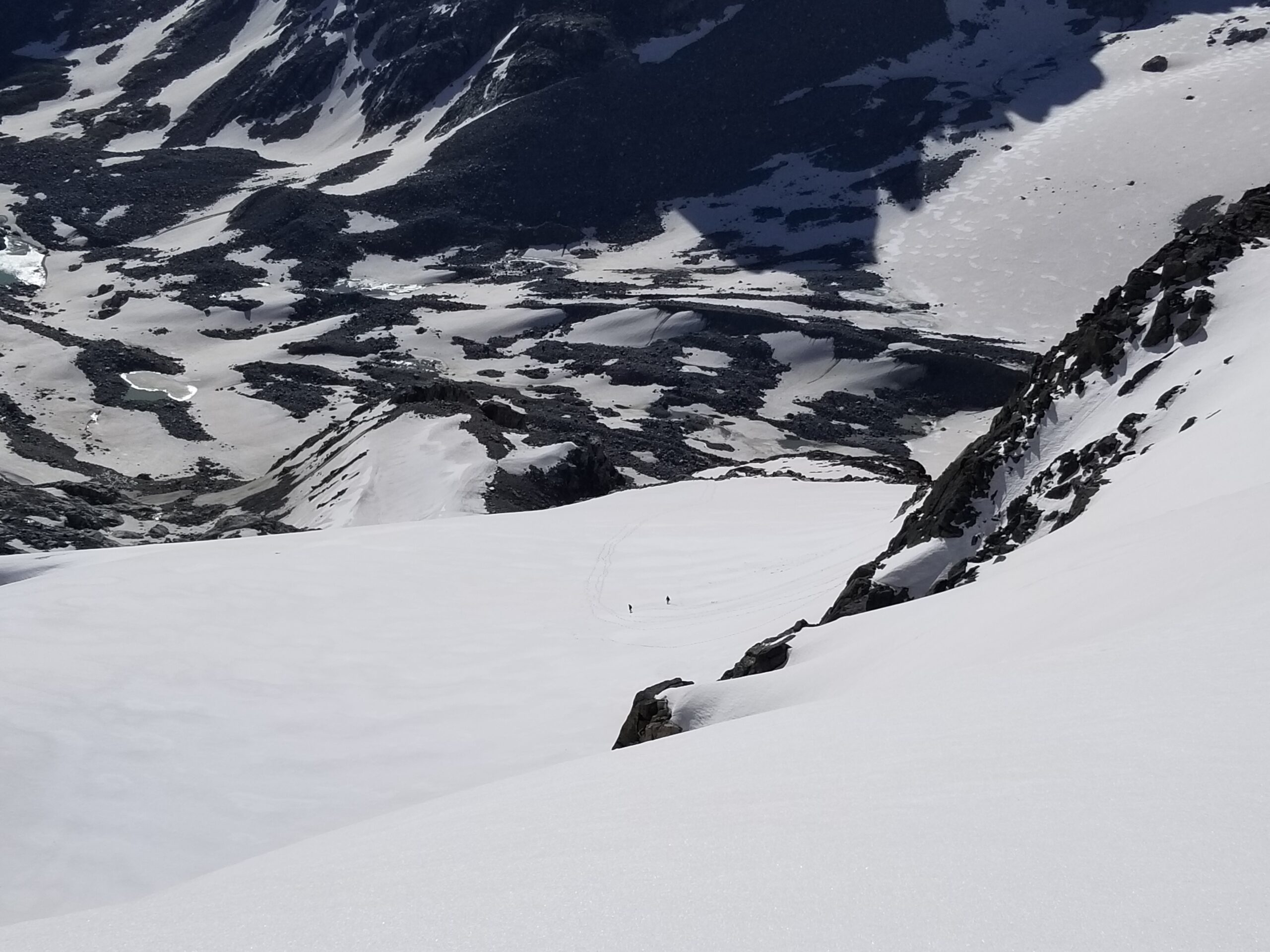
- Southwest Ramp - This has become the standard route in recent years due to the easier summitblock technical requirements, and a more accommodating base camp in the lakes basin as opposed to the frigid plateau. Climbers begin from the southwest at the upper (or lower) Lady-of-the-Lakes trailhead. From here it is a long trailed approach, requiring several stream fords either to an Aero Lakes, or Sky Top Lakes camp. Sky Top is typically preferred since it bypasses additional elevation loss required by an Aero Lakes overnighter. On summit day, climbers will navigate steep talus aprons to locate the namesake ramp, or couloir. Here, the biggest danger is rockfall hazard, but a straightforward class 3 scramble to the top. Earlier in the season, it will be a steep snow climb requiring crampons and ice axe. The RT stats total out to be 28 miles and 6000 feet of cumulative gain.
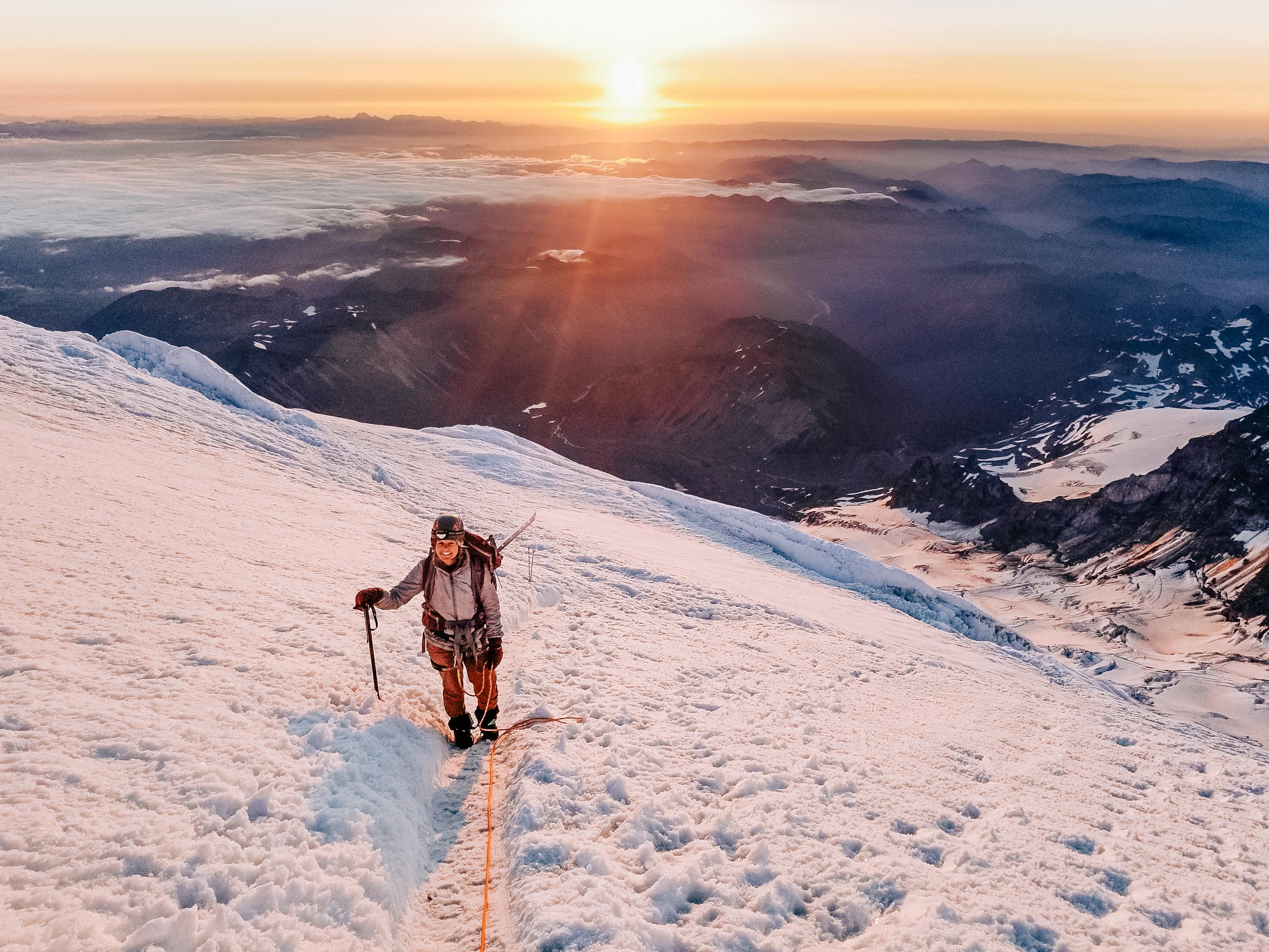
Rainier - By far and away the most accepted easiest route up Tahoma is the Disappointment Cleaver (DC) route. My wife wrote a full guide to the Disappointment Cleaver Route Here - https://shaleewanders.com/climbing-mount-rainier-disappointment-cleaver-route/.
After securing the required backcountry camping permits, climbers begin at the expansive Paradise parking lot and hike the trail until departure onto the Muir Snowfield. After thousands of feet of steep elevation gain, climbers find themselves at Camp Muir. After an early night, an alpine start is required as climbers will immediately rope up to cross the Cowlitz and Ingraham glaciers. Thanks to the efforts by RMI Expeditions and their comprehensive client guiding services, no routefinding is required as private parties follow the boot path marked with wands. The exact route varies depending on seasonal melt progression, and availability of snowbridges. The major constant is the Cleaver itself, a steep rocky feature that will require a little bit of class 2 scrambling. Aside from that, the few ladders and aluminum bridges placed by guides will be the biggest obstacle to the summit crater and Columbia Crest, the highpoint of this massive Volcano. The RT stats of a DC climb totals out to about 16 miles and 9200 feet of gain.
A similarly difficult alternative to the Disappointment Cleaver route is the Emmons Glacier approach. Climbers sacrifice an additional 1500’ of gain and several more miles, for increased solitude, and autonomy in routefinding choices as crevasse navigation is the responsibility of the challenging parties. A more rewarding climb perhaps, without obvious guide assistance.
Gannett - There are three main routes up to the summit of the champion of the Wind River Range, and each of them have their merits depending on the climber's choice. My wife wrote a full guide to the Disappointment Cleaver Route Here -
https://shaleewanders.com/everything-to-know-about-climbing-gannett-peak-in-wyoming/.
- Glacier - This classic standard route begins from the Glacier trailhead from the north, closest to Dubois. Climbers spend several days navigating 25+ miles of trail and unbridged stream crossings before arriving in the Dinwoody glacial basin. Summit day involves teamed rope travel up the expansive Dinwoody Glacier and navigating the infamous bergschrund (seasonal dependency). Careful routefinding and some class 3 scrambling will bring you to the iconic capped summit ridge. RT stats involve near 56 miles and 10,500 feet of cumulative gain
- Titcomb Basin/Bonney Pass - This similarly used approach to Gannett begins at the Elkhart Park trailhead near Pinedale. Climbers will backpack many miles through several lake basins and a few stream fords to ultimately arrive somewhere in the majestic Titcomb Basin. Summit day involves the same Gooseneck Pinnacle route as Glacier, but including a tedious preamble climb up to the infamous Bonney Pass, and additional glacier routefinding along the Dinwoody. RT stats ballpark at 42 miles and 9200 feet of cumulative gain
- Tourist Creek - This route is chosen by climbers who prefer scrambling and off-trail adventures more than glacial travel. It begins at the remote Green River Lakes trailhead and involves 10-12 miles of trail with the scenic squaretop mountain as a backdrop. From the Three Forks park vicinity, the hard work begins as miles of talus navigation with some bushwhacking is imminent. Once situated at the west side of the Gannett mass, more routefinding, and some light class 4 scrambling will be required to reach the peak. RT stats clock in near 38 miles and 8000 feet of cumulative gain.
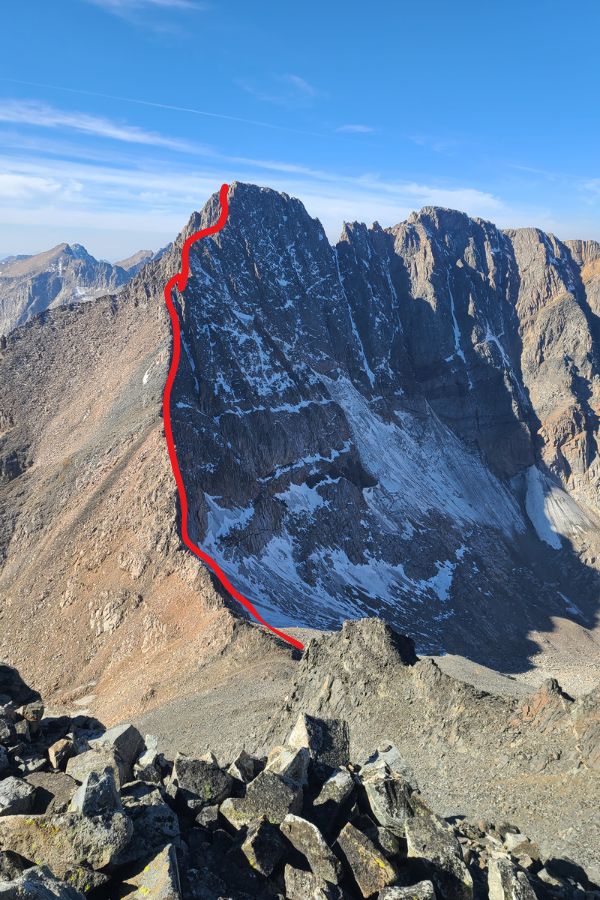
Granite Peak - Classic Ridgeline with high 4th class exposure
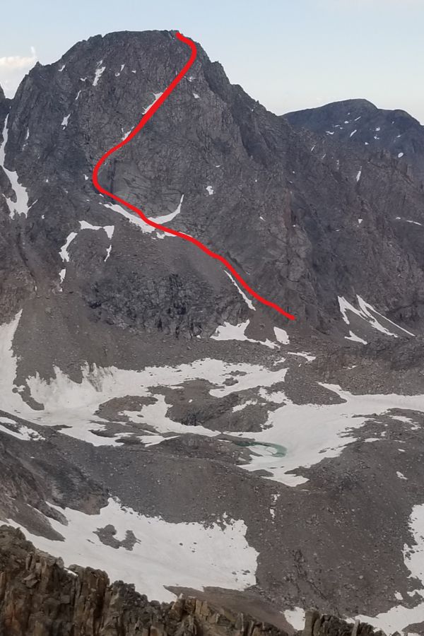
Granite - Alternative 3rd class southwest ramp route
Granite vs. Gannett vs Rainier: Weather
This is a big tangible to consider when approaching a difficulty assessment of the three peaks. Poor weather can make or break your summit bid, whether or not every challenging element was satisfied in order to reach the top.
Granite - The Beartooths are known to have some of the most volatile weather of any range in the United States. Violent afternoon storms are common, and they often approach with a sudden ferocity that makes it extremely difficult for an evasive maneuver mid-climb. The lightning presence and heavy winds produced by these storms make for extremely dangerous situations, especially in a place as exposed as the Granite summitblock. Weather is often the sole reason many Granite climbs fail.
Rainier - This massive volcano creates its own weather, and is often wildly unpredictable. Mild weathered days have turned severe in minutes, and there are many stories laden in tragedy from this factor alone. Thunderstorms aren’t typically a problem as with other rocky mountain peaks, instead there is potential for dramatic temperature swings, impossibly strong winds, and a complete loss of visibility. Typically the summer months can accommodate more stable weather, but extreme events can happen anytime, and forecasts aren’t always even remotely accurate.
Gannett - In the heart of the Wind River range, anything is possible. This range tends to have a bit more stability compared to the Beartooths to the north, or the Colorado Rockies to the south, but afternoon storms are still common and can be deadly. Additionally, heavy snowstorms can descend on the range at any month last-minute (especially late-season), and it's very difficult to evacuate so deep in the back country. During my summit day on Gannett, I had a run-in with a near miss of a lightning storm while high on the peak at 8am! Illustrating the unpredictability of the area.
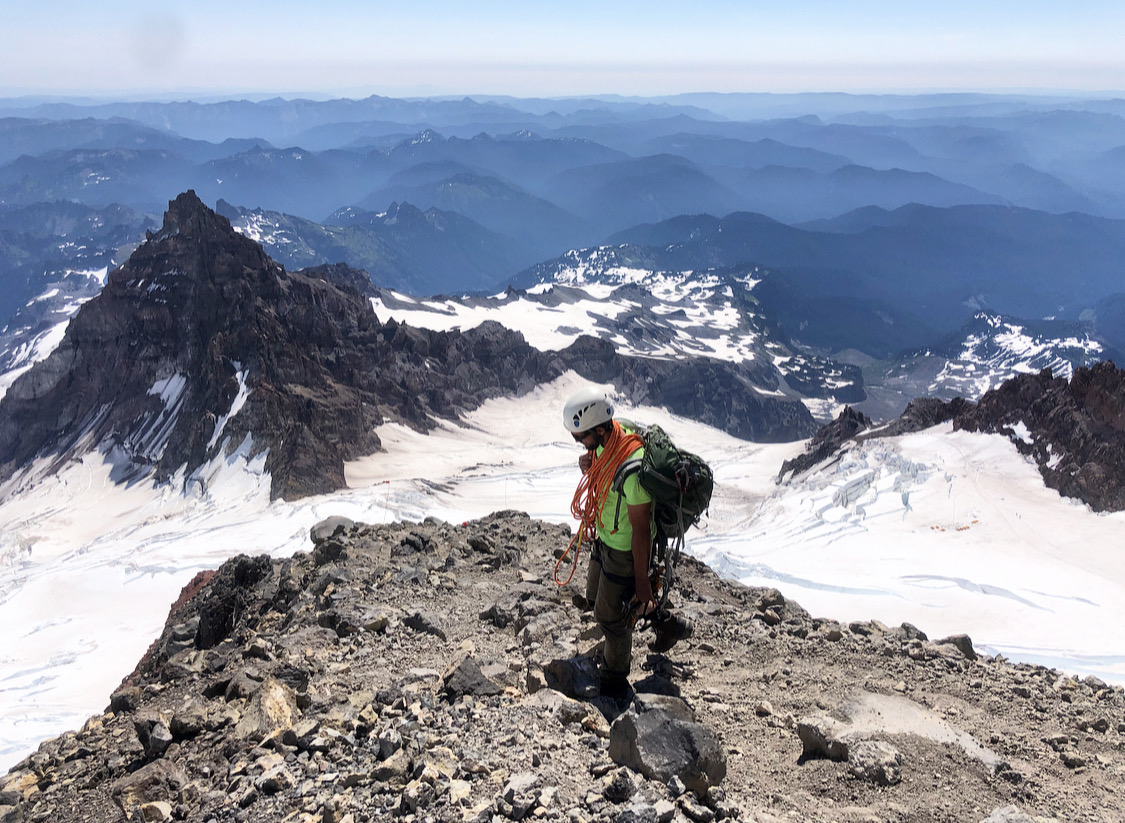
Mount Rainier - Top of Disappointment Cleaver
Exposure (Fear Factor)
Granite - Of the three, this is the peak with the smallest and steepest profile. Even taking the easier of the two routes via the Southwest Ramp, the exposure is still considerable and may shock those coming from other objectives within the state highpoint list. For those choosing to challenge themselves with the intimidating 4th class east ridge route, this entire factor is multiplied. The east ridge route is truly exposed and the closest thing to rock climbing in the pursuit of a “standard” route up any of the 50 highpoints, including Denali. It makes Borah’s chicken-out-ridge look like Mt Sunflower.
Rainier - Tahoma’s standard routes are exposed in the sense of wide-open glacial expanse. You may get a sense of vertigo as you stare down into the endless abyss of a massive crevasse that you have to step or climb over along the way. The cleaver section of the route has a little bit of steep steps here and there, and some big drops along the way, but scramble exposure is still limited.
Gannett - Most of the exposure on this peak is limited to the less-standard routes up the mountain. The west side is a lengthy scramble, but still only has a small portion of significant airy footwork transitioning to the north ridge. In terms of snow steepness, the standard east routes on Gannett contain the most sustained moderate grades of the three peaks, so if conditions are icy, this can be a major problem. Extended open exposure to alpine wilderness and glacier travel can also eventually weigh heavy on mental stamina.
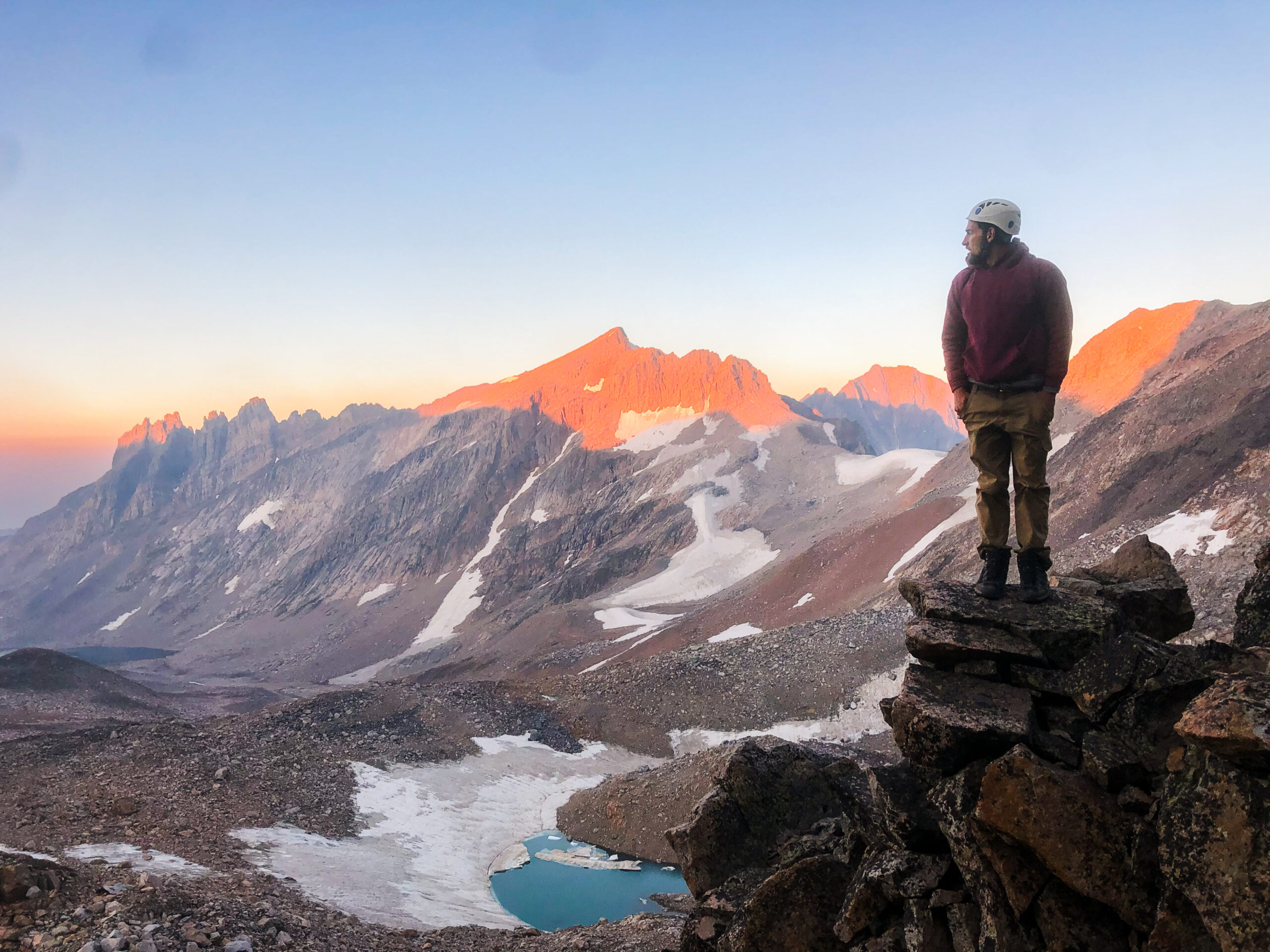
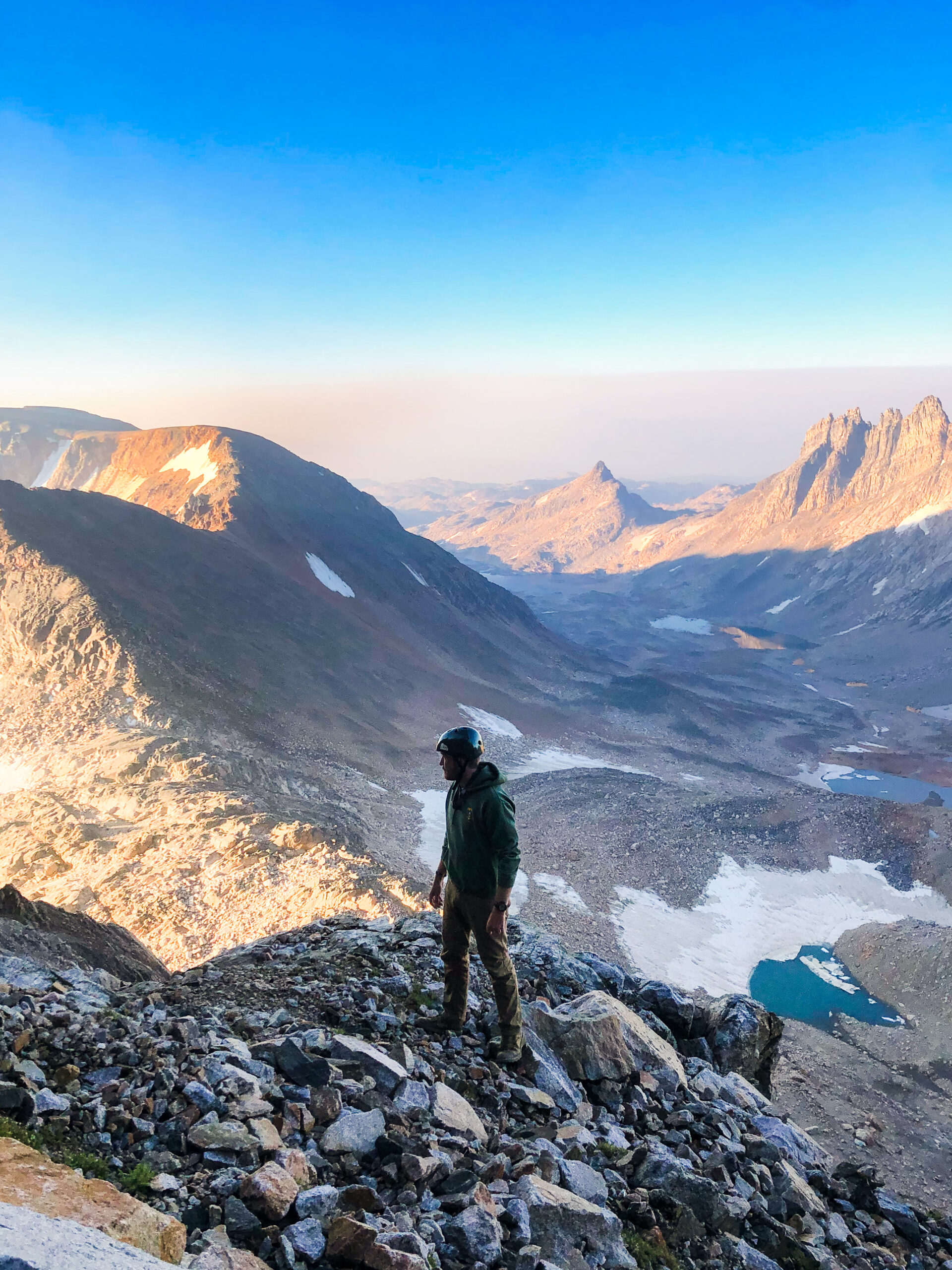
Sunrise from Granite, Southwest Coulier
Granite vs. Gannett vs Rainier: Physicality
Granite - The pack into a Sky Top lakes camp is similar to that of Gannett’s approach unless setting up on top of Froze-to-Death Plateau. In that case it's a 5000’ gain with a heavy pack, plus some off-trail travel. Granite is the lowest peak of the 3, and the least total elevation gain, but not by much.
Rainier - Typically requires the most gear and therefore, pack weight. With a 4800’ gain to the overnight at Camp Muir, and more from other routes - this endeavor is nothing to sneeze at. Paired with the biggest elevation differential and highest altitude, an attempt at Rainier will test your limits. The one advantage of this climb is having to undergo the least mileage of the 3, by a wide margin.
Gannett - Requires an intimidating 38 miles RT minimum, and over 8000 feet of gain. It is more from either of the two routes that don’t require bushwhacking and significant off-trail travel. In terms of raw stats, Gannett is the king of the lower 48.
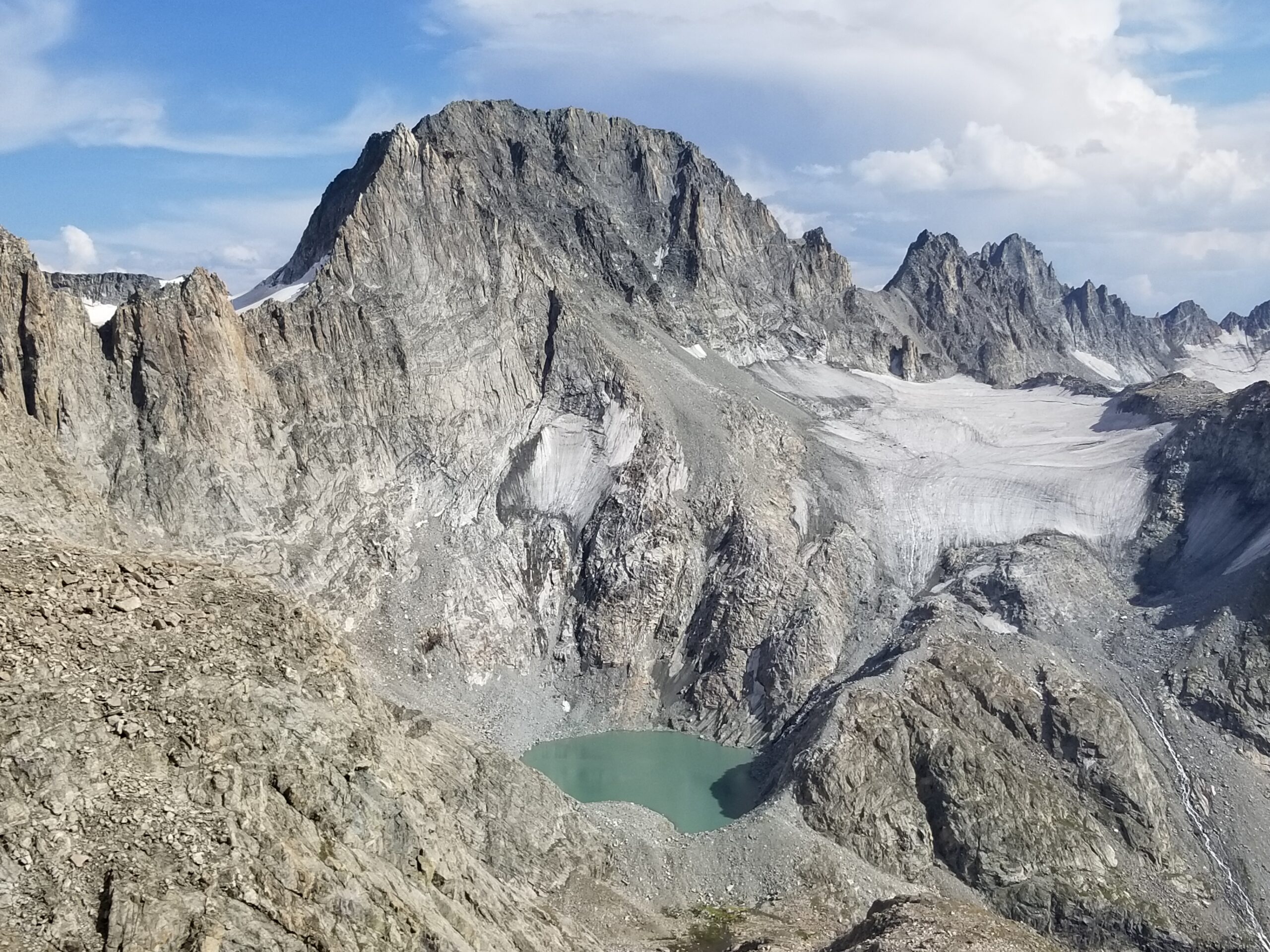
Gannet Peak
Granite vs. Gannett vs Rainier: Wildlife
Granite - The big mammal wildlife in the Beartooths is more robust than either of the other 2 peaks. Grizzly bear altercations are somewhat uncommon but still have the potential to occur, especially to the south near the Lady-of-the-Lake trailheads and Cooke City. The bordering Absaroka range is loaded with Griz, but they tend to stay below treeline here; you won’t see them very often in the high Beartooth alpine. You will, however, very likely see Mountain Goats, which frequent the entire high alpine of the Beartooths. They are especially notorious near the Sky Top lakes area. There have been a number of stories of them keeping campers up in the middle of the night licking the nearby rocks or ground, pining for salt in urine. Probably a good idea to relieve oneself further away from the tent than usual. Bighorn Sheep can also be spotted, a bit more rarely and near the outskirts of the range. Same situation with Elk, Black Bear, and Moose. Marmots and pikas are also a common sight.
Rainier - There are also mountain goats in the alpine zone of Rainier, although you aren’t likely to see them alongside the Disappointment Cleaver circuit due to the heavy human traffic in the area. They can be found in many other sections of the park. Marmots can be a concern when it comes to gear or tent damage, so be sure to take the proper precautions. Pika and perhaps even a fox could be spotted up high. Nothing dangerous here.
Gannett - Grizzly bears are rumored to roam through the Wind River range, but it is certainly not common. They would be deviating from known territory towards the Gros Ventre range to the West and Absarokas to the North. I haven’t heard of one seen anywhere along the Titcomb Lakes approach, but could be possible near the Green Lakes area or the Glacier trail approach. Moose are fairly common on the southern approach towards Pinedale. They generally stay lower in the alpine by swampy terrain within treeline. Black bears can be found wherever in the woods but are almost never a problem. Marmots and Pika are very common and the former is worth taking precautions for food and sweaty gear storage. Perhaps the biggest wildlife wild card worth noting in the Wind River range is the frequency of bigfoot encounters. The folklore is alive and well locally! This author even had a strange unexplained encounter high on the Fremont Glacier one evening. If you find yourself in a more remote section of the Winds, keep an eye out!
Two people traversing the lower glacier of Gannett
Granite vs. Gannett vs Rainier: Gear
Granite - Early season, perhaps even up until early August, will likely require crampons and ice axes for both approaches, to navigate the snow-filled ramp, or to navigate the snowbridge on the eastern col. Upon tackling the east ridge, many parties bring rap gear as downclimbing the exposed 4th class pitches can be tough.
Rainier - To ensure safety, you will need quite the variety of gear and skills, notably crevasse rescue devices and techniques. You’ll need at least a rope, ice axe, crampons, helmet, harness, pulleys, prussiks, picket(s), belay device, carabiners, along with cold weather overnight gear. Outside of the peak climbing season, you may need even more gear. This equates to a heavy pack that you have to haul many thousands of feet up the mountain, and even a heavier-than-usual summit haul.
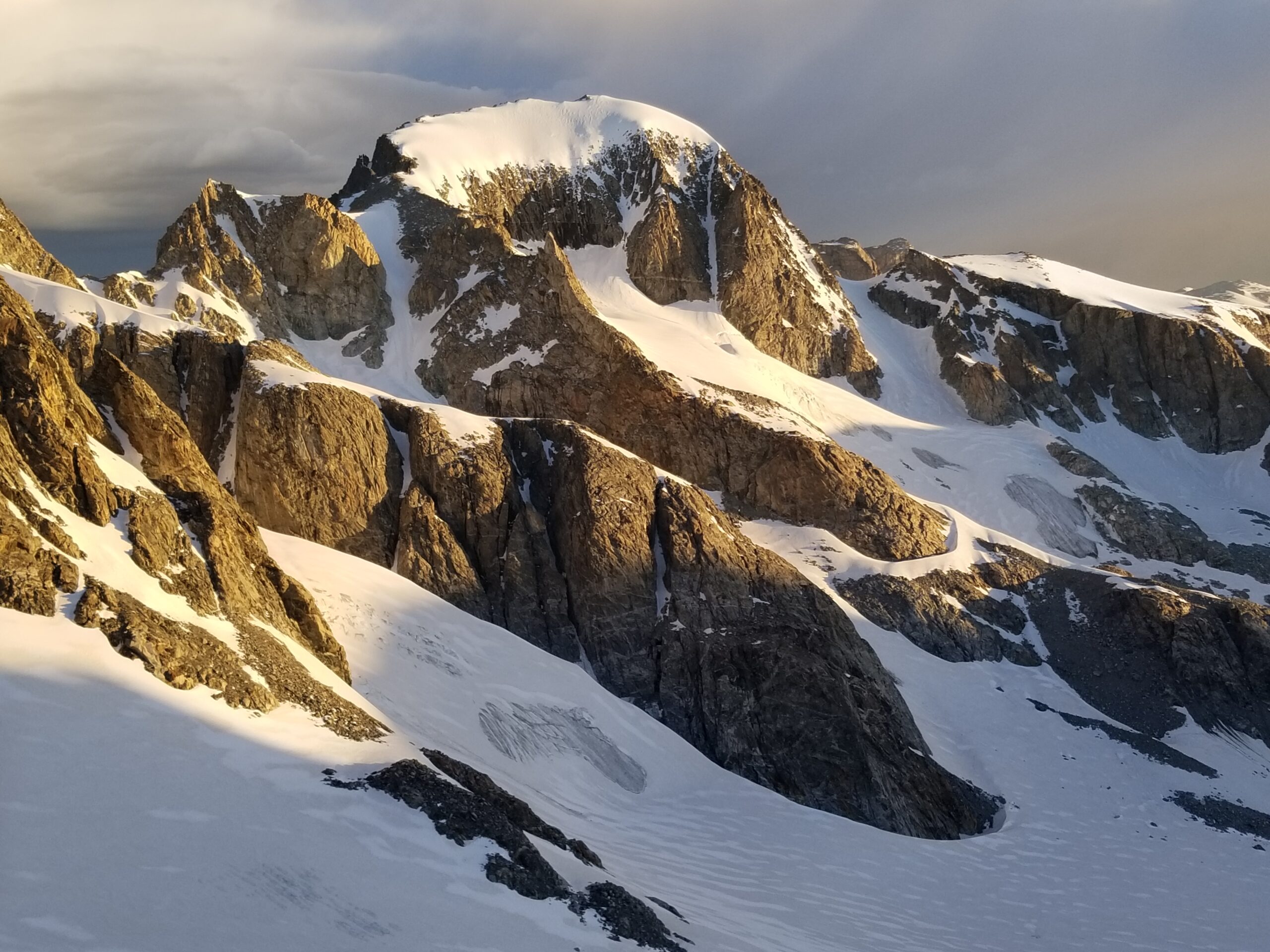
Gannett - Depending on the bergschrund conditions, you may need all of the gear listed above for Rainier. When I did it on July 4th, the snowbridge was well intact and I only used crampons and an ice axe. However, the full roped setup is always advised as there will be extended travel over crevassed glaciers. The risk is the highest from the Bonney Pass approach, and the least from the Tourist Creek route (the glacier travel is very short with minimal crevasse risk). The crevasses are much smaller and less numerous than those found on Rainier, but they still can swallow a party member whole. The bergschrund feature tends to open mid to late July. August attempts this will almost always be a factor and the later you go the harder it will be.
Mount Rainier - Upper Glaciers
Granite vs. Gannett vs Rainier: Hazards & Risk
Granite - The biggest hazards in the Beartooths are the sudden and violent changes in weather, and the shifty rock. I’ve spent a fair amount of time in the range and the most frightening thing is just how insecure many of the massive talus blocks can be. Indeed, on the day we summited, a party was rappelling from a chockstone on Granite’s east ridge. The stone dislodged, killing one and injuring the other. Please respect these mountains! It’s a beautiful area but many climbing accidents have occurred over the years for the relatively low traffic it receives compared to other ranges. Lightning risk is also very high, and Granite itself is an infamous lightning rod as it rises dramatically from the nearby plateaus and basins.
Rainier - Abrupt weather changes also account for many deaths and injuries on this massive volcano as well. Outside the peak climbing season, this factor is even more exacerbated, along with the increased risk of deadly avalanches. Although the Seracs (giant ice formations at the edges of glaciers/crevasses), are more stable than they appear, there is always a risk that they may collapse and flatten anyone who stands beneath them. Obviously, the incredible number of crevasses and immense size and depth, are a constant risk, and snowbridges weaken and collapse every day. Another lesser obvious risk is the sheer number of traffic this peak gets every day (more than double the other two mountains combined). Climber falls, human dislodged ice, or rock on the cleaver may put your party at risk.
Gannett - Similarly to the other two - weather, rock, and ice all present their own hazards in any situation. Crevasse danger is a threat on the glacier approaches, and rock fall can occur from above at any time. The remoteness and ruggedness of this range can be the biggest cause for concern - it is a long way out and there is a lot of potential for any number of injuries both ways.
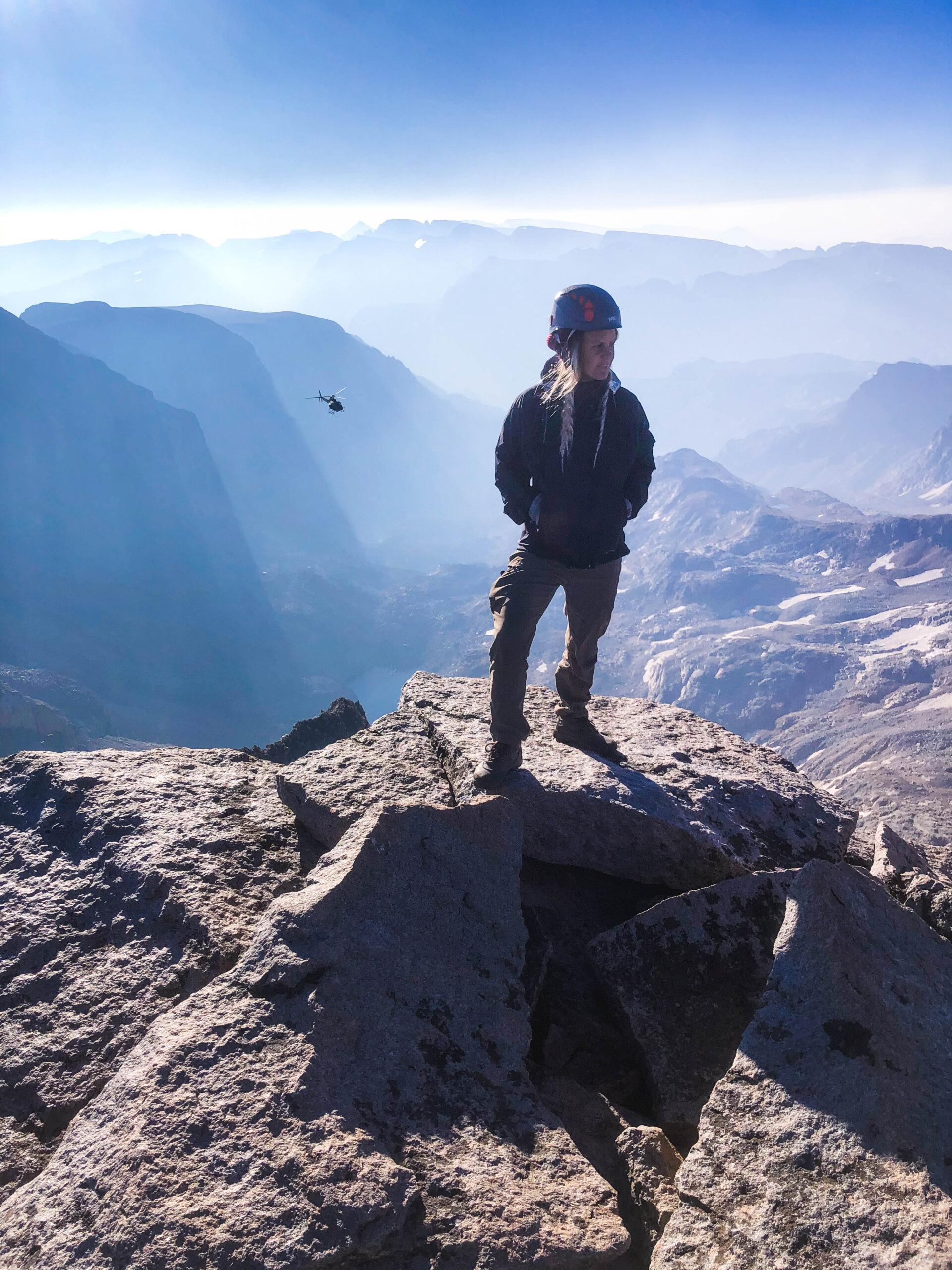
Rescue helicopter on a recovery mission from the summit of Granite Peak
Isolation
Granite and Gannett Peak are both incredibly isolated, located 10 and 14 miles from the nearest paved road, respectively. Both ranges receive significantly less traffic than that of Rainier and the National Park. You’re unlikely to be alone out there, especially in peak climbing season with very narrow ideal-condition summit windows. But if you get yourself in trouble, help can be a long way away. Self reliance is important for these peaks within these deep rugged wildernesses.
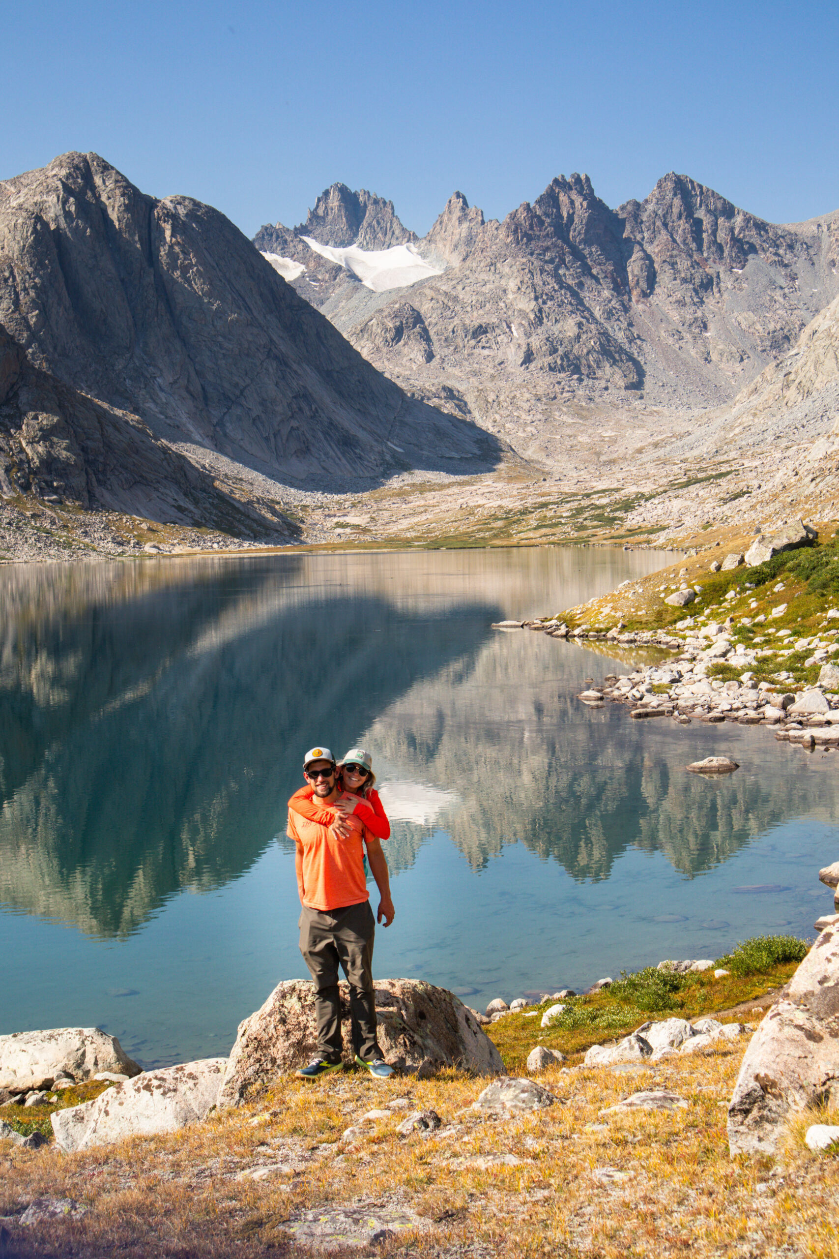
Titcomb Basin - the most common basecamp for Gannett. 18 miles from the closest trailhead. Bonnie Pass is to the far left.
Summary - What is the Hardest U.S. State Highpoint?
Southwest Coulier - Granite Peak, Montana
Final Verdict: What is the Hardest U.S. State Highpoint?
The technical difficulty of Granite has been nerfed, so to speak, with the recent acceptance of the Southwest Ramp as the easiest ascent route. That leaves Rainier and Gannett. A Gannett climb often includes the same technical elements on glaciers as Rainier, just with less and smaller hazards. Comparing both routes in optimal conditions, I believe the Bonney Pass route on Gannett is overall harder than the Disappointment Cleaver route on Rainier. Clearly, the comparison is plenty nuanced and will depend on personal preference and experience. Conditions, weather, headspace, and physical health at the time of climb will also play a huge factor. Climb them all and let us know what you think

At any given moment, Shalee is either lost, hunting for ice cream, or obsessively planning her next adventure.
Born and raised in rural Michigan, she began exploring the shores of Great Lakes as a teen, often sleeping in her car to save money. Eventually, her urge to explore pushed beyond her Midwest borders. Today, Shalee shares her tips and stories to thousands of readers interested in adventure and outdoor tourism. Her pack now includes two spunky hiking cats and her partner, Josh. Learn more about her here.
Join the Adventure


")