Longs Peak Hike: What to Expect When Climbing Colorado’s "Deadliest" Mountain
June 15, 2020
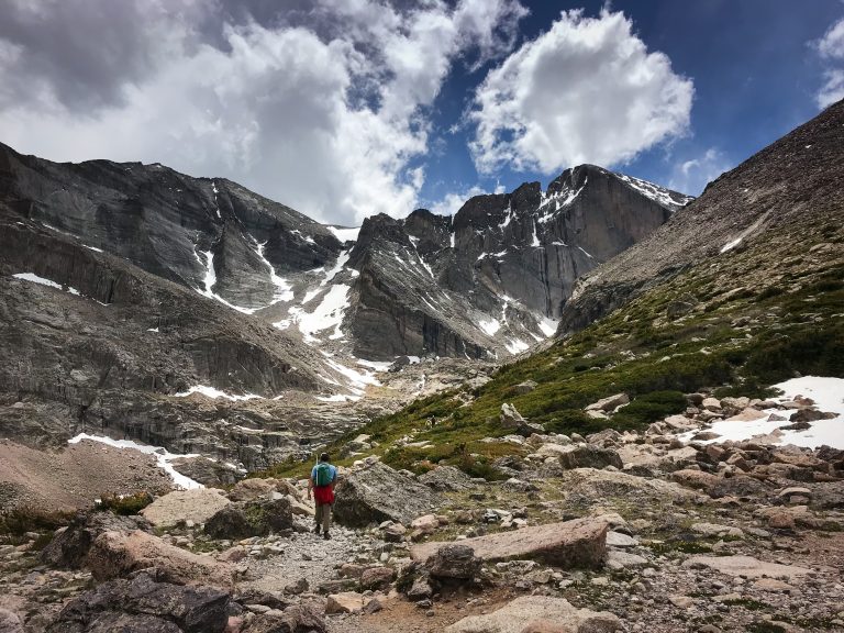
In terms of statistics, Longs Peak is only 14th on the list of hardest 14ers to climb in Colorado. There is no class 5 climbing and the trail is well-marked and easy to follow. However, it’s an isolated and difficult 14er located within Rocky Mountain National Park, making it an accessible mountain for a lot of unprepared hikers. Each year, thousands of hopeful hikers aim for the summit, but less than 50% succeed.
The Keyhole Route is the most popular trail to the summit and includes 15.1 miles round trip with an elevation gain of 5100ft. The route is broken up into six different sections:
- The Approach – an easy hike up the first 5.5 miles.
- The Keyhole – the start of the more technical hiking after the Boulderfield.
- The Ledges – a short traverse with mild exposure.
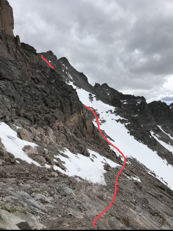
- The Trough – steep gully with light scrambling.
- The Narrows – second traverse with medium exposure but solid rock.
- The Final 300 – second steep gully + scramble to the summit.
Overall, the Longs Peak hike is well worth the misery and long mileage. Before you head out to bag the iconic peak, there are a few things to take into consideration:
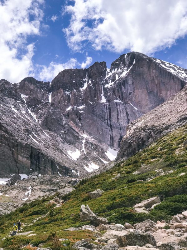
Longs Peak Hike: What to Expect When Climbing Colorado’s "Deadliest" Mountain
1. The Approach is actually incredibly easy.
It is 7.5 miles to the summit from the trailhead and the first 5.5 miles are, well, almost too easy. It consists of a gradual incline with a lot of flat terrain to give yourself a break as you gain elevation. The first two miles consist of a couple of switchbacks through a pine forest. From there, you break the tree line and follow the path another mile until you reach the fork for Chasm Lake. After that, the trail levels out for .6 miles as you traverse across the base of Mt. Lady Washington before heading up to finish the last 1.5 miles to the boulder field. Don’t let this fool you. The real fun is taunting you ahead.
2. Don’t hit the snooze.
After just 2.5 hours of sleep, we woke up at 1:30am to drive three hours to the trailhead, left the car around 4:30am, and made the summit by 10:15am. Now, that may seem early, but one of the biggest threats of 14ers are afternoon storms. Even on clear days, unexpected clouds often build over the mountains starting around mid-day. On our way down, we were surprised by the number of groups just making it to the Keyhole around noon. Sure enough, dark clouds rolled in roughly an hour later. Hard to tell if they ever made it.
In total, it was 11 hours round trip with an hour spent at the summit.
3. Check trail conditions
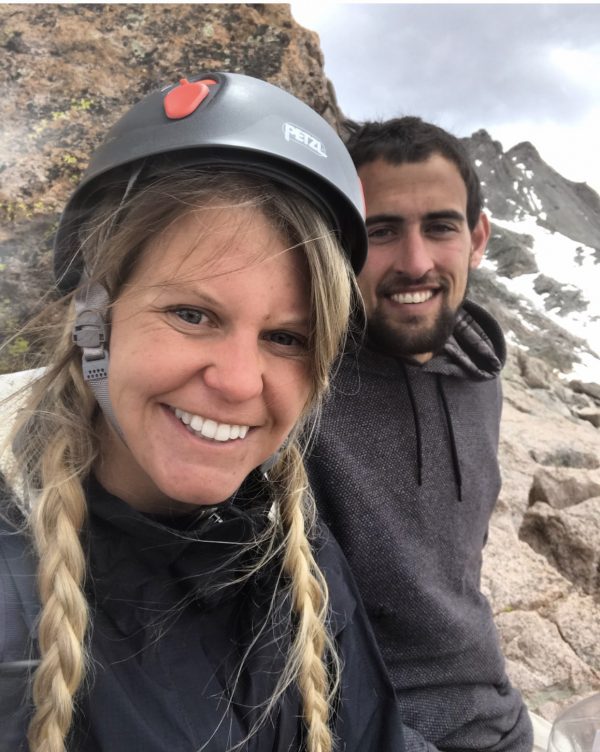
One of the most vital aspects of a successful summit is checking trail conditions before you go. You can check them through the National Park Service here. We summited on June 7, 2020, and brought ice axes, crampons, and helmets. Just as we entered the Keyhole, we met groups coming back that were turned around due to snow conditions ahead that didn’t have the proper gear. The beginning of summer can bring lighter crowds (we had the summit to ourselves), but it also means that snow conditions can be unpredictable.
4. For me, the elevation was worse than the scramble.
Altitude is never friendly to me. I spent most of my time on top of Nevada’s highest peak, Boundary, in a fetal position and vomiting at 13,000 feet. Thankfully, a combination of goodwill and Tylenol kept my struggle manageable. However, my nausea started around 12,000ft, per usual. If you’re flying to Colorado and plan to grab this peak, spend some time hiking at lower elevations first before you jump straight into a 14er.
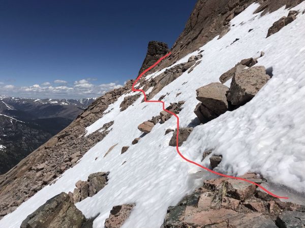
The Ledges, early June 2020
5. Now, the scramble and traverse.
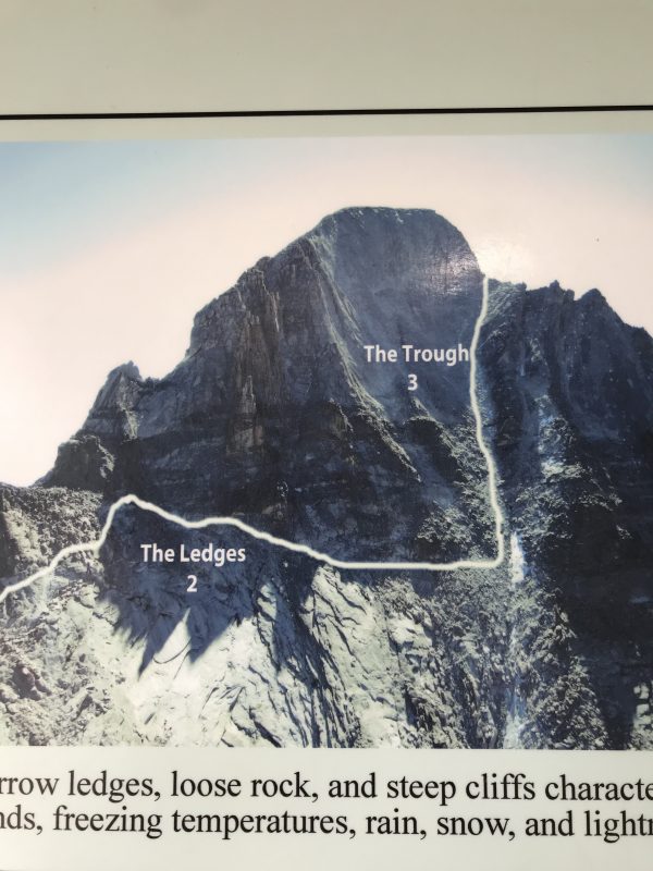
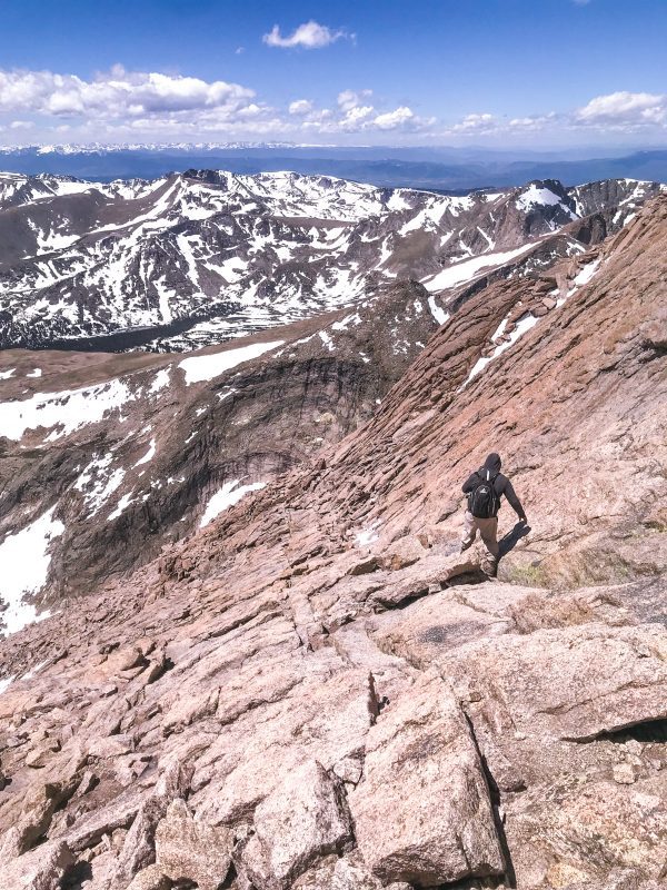
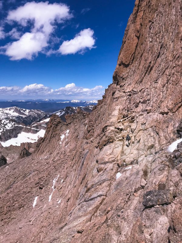
The Keyhole route of the Longs Peak hike consists of mostly class 3 scramble and traverses with exposure. The Ledges are the first traverse after the keyhole. The trail is pretty narrow but as long as your follow the obvious spray-painted trail markers, you’ll navigate around the near-vertical cliff-face. This section also holds onto snow the longest and may require ice axes/crampons into June. After that, you’ll reach the Trough, which is a longggggg gully that, in my opinion, is the most annoying part of the entire route. It has no exposure, but with the elevation + length + steepness you’ll be fighting it for a while. You’ll hope the summit is at the top, but alas you’ll finally make it only to see there is more climbing in your future.
After the Trough, there are still two shorter sections to conquer. The first is the Narrows, a second traverse that includes some exposure but has a solid rock route to follow with easy moves. After that, you’re at the homestretch, which includes the last 300 feet of the climbing to the summit. The section is pretty slabby with fewer boulders and can look intimidating at first, but slow and steady wins the race. Thankfully, the ledge you see ahead is the brink of the summit. You’re almost there! Watch your footing on the way down this section as a slip here would definitely ruin a successful summit day.
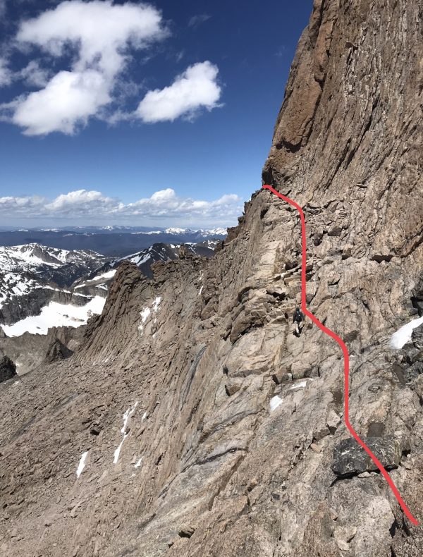
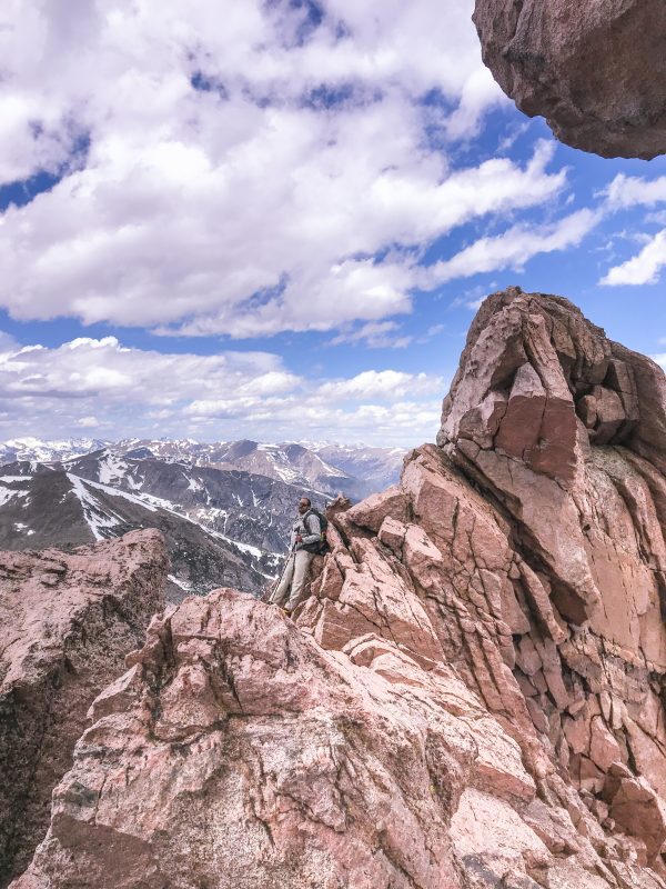
#1: The Narrows, Early June
#2: Looking at the Trough from The Ledges
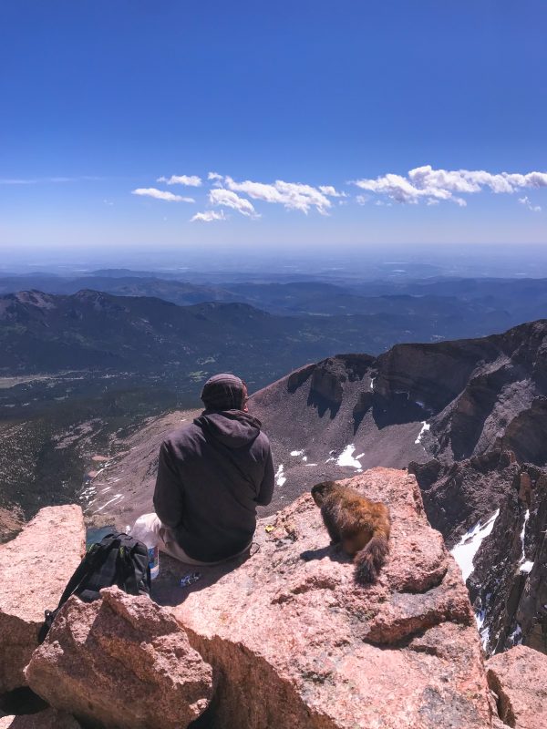
6. There’s a marmot at the summit.
But most importantly, Yogi the Marmot likes peanut butter sandwiches, breaking into backpacks, and sniffing hikers’ ears as they are resting at the summit. He is there, and he will passive-aggressively eyeball you as you enjoy your summit snack.
Longs Peak Hike: What to Expect
Overall, if this is your first summit, it might be time to reconsider. There are plenty of other mountains in the area to get you started. The Longs Peak hike is a unique 14er that requires determination, confidence, and calculation. If you have a fair share of noteworthy hikes/peaks in your book, it should be a fun day route that still provides a challenge. Enjoy it! The scenery and adventure doesn’t get much better than this.
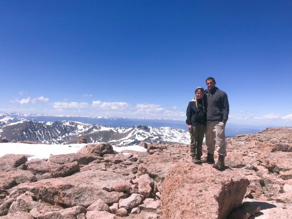

At any given moment, Shalee is either lost, hunting for ice cream, or obsessively planning her next adventure.
Born and raised in rural Michigan, she began exploring the shores of Great Lakes as a teen, often sleeping in her car to save money. Eventually, her urge to explore pushed beyond her Midwest borders. Today, Shalee shares her tips and stories to thousands of readers interested in adventure and outdoor tourism. Her pack now includes two spunky hiking cats and her partner, Josh. Learn more about her here.
Join the Adventure


